File:Australia_Northern_Territory_relief_location_map.png
From Wikipedia, the free encyclopedia
Original file (1,339 × 1,862 pixels, file size: 802 KB, MIME type: image/png)
| This is a file from the Wikimedia Commons. Information from its description page there is shown below. Commons is a freely licensed media file repository. You can help. |
Summary
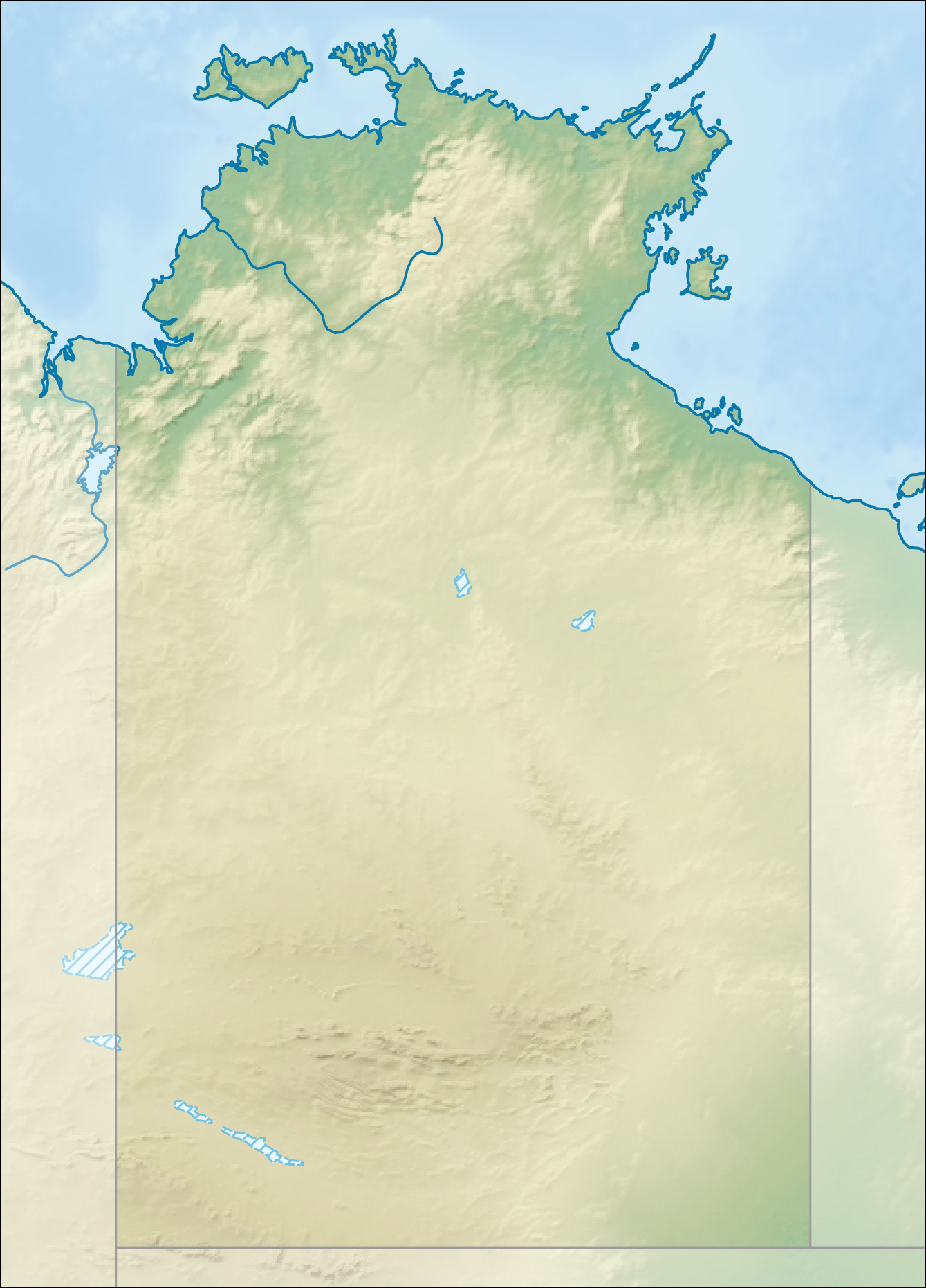
| DescriptionAustralia Northern Territory relief location map.png |
Relief location map of the Northern Territory, Australia Equidistant cylindrical projection, latitude of true scale 17.75° S (equivalent to equirectangular projection with N/S stretching 105 %). Geographic limits of the map:
|
| Date | |
| Source |
|
| Author | Tentotwo |

|
This map has been made or improved in the German Kartenwerkstatt (Map Lab). You can propose maps to improve as well.
azərbaycanca ∙ čeština ∙ Deutsch ∙ Deutsch (Sie-Form) ∙ English ∙ español ∙ français ∙ italiano ∙ latviešu ∙ magyar ∙ Nederlands ∙ Plattdüütsch ∙ polski ∙ português ∙ română ∙ sicilianu ∙ slovenščina ∙ suomi ∙ македонски ∙ русский ∙ ქართული ∙ հայերեն ∙ বাংলা ∙ ไทย ∙ +/−
|
Licensing
- You are free:
- to share – to copy, distribute and transmit the work
- to remix – to adapt the work
- Under the following conditions:
- attribution – You must give appropriate credit, provide a link to the license, and indicate if changes were made. You may do so in any reasonable manner, but not in any way that suggests the licensor endorses you or your use.
- share alike – If you remix, transform, or build upon the material, you must distribute your contributions under the same or compatible license as the original.
Captions
Items portrayed in this file
depicts
2 February 2013
image/png
0294c8599b32cbbf71c56efae0e2ca981f1dc372
821,246 byte
1,862 pixel
1,339 pixel
File history
Click on a date/time to view the file as it appeared at that time.
| Date/Time | Thumbnail | Dimensions | User | Comment | |
|---|---|---|---|---|---|
| current | 18:01, 2 February 2013 | | 1,339 × 1,862 (802 KB) | Tentotwo | User created page with UploadWizard |
File usage
More than 100 pages use this file. The following list shows the first 100 pages that use this file only. A full list is available.
- Adelaide River
- Alligator Rivers
- Angas Downs Indigenous Protected Area
- Anna's Reservoir Conservation Reserve
- Arnold River (Northern Territory)
- Barranyi (North Island) National Park
- Beagle Gulf
- Blackmore River
- Blackmore River Conservation Reserve
- Bombing of Darwin
- Buckingham River
- Bullwaddy Conservation Reserve
- Calvert River
- Caranbirini Conservation Reserve
- Casuarina Coastal Reserve
- Central Mount Stuart
- Channel Point Coastal Reserve
- Charles Darwin National Park
- Charlotte Waters, Northern Territory
- Clarence Strait (Northern Territory)
- Connells Lagoon Conservation Reserve
- Corroboree Rock Conservation Reserve
- Daly River (Northern Territory)
- Daly Waters Airfield
- Djukbinj National Park
- Dry River (Northern Territory)
- Dundas Strait
- Edith Falls
- Elizabeth River (Northern Territory)
- Fish River Station
- Fitzmaurice River
- Florence Falls
- Fogg Dam Conservation Reserve
- Gabarnmung
- Garig Gunak Barlu National Park
- Goromuru River
- Groote Eylandt
- Gunlom Falls
- HMAS Coonawarra
- HMAS Melville (naval base)
- Heavitree Gap
- Henbury Meteorites Conservation Reserve
- Illamurta Springs Conservation Reserve
- Jim Jim Falls
- Kakadu National Park
- Karlu Karlu / Devils Marbles Conservation Reserve
- Kata Tjuta
- Katherine River
- Keep River
- Keep River National Park
- Kelly Hills
- Kintore Caves Conservation Reserve
- Kuyunba Conservation Reserve
- Lake Alexander (Northern Territory)
- Lake Amadeus
- Lake Bennett (Northern Territory)
- Lake Mary Ann
- Lake Neale
- Litchfield National Park
- Liverpool River
- MacDonnell Ranges
- Mac Clark (Acacia peuce) Conservation Reserve
- Mary River (Northern Territory)
- Mary River National Park
- McArthur River
- Melville Island (Northern Territory)
- Mount Conner
- Mount Giles
- Mount Liebig
- Mount Sonder
- Mount Unapproachable
- Mount Zeil
- Napwerte / Ewaninga Rock Carvings Conservation Reserve
- Native Gap Conservation Reserve
- Nourlangie Rock
- Ormiston Pound
- RAAF Base Darwin
- RAAF Base Tindal
- Rainbow Valley Conservation Reserve
- Roper River
- Sandover River
- Serpentine Gorge
- Shoal Bay (Darwin)
- Shoal Bay Coastal Reserve
- Tarrabool Lake
- Tjaynera Falls
- Tjoritja / West MacDonnell National Park
- Tolmer Falls
- Top End
- Twin Falls (Northern Territory)
- Uluru
- Uluṟu-Kata Tjuṯa National Park
- Van Diemen Gulf
- Victoria River (Northern Territory)
- Wangi Falls
- Watarrka National Park
- Wessel Islands
- Wickham River
- Wildman River
- User:Michael!/Project:Location map templates/Australia
View more links to this file.
Global file usage
The following other wikis use this file:
- Usage on als.wikipedia.org
- Usage on azb.wikipedia.org
- Usage on ban.wikipedia.org
- Usage on bar.wikipedia.org
- Usage on bg.wikipedia.org
- Usage on ceb.wikipedia.org
- Usage on da.wikipedia.org
- Usage on de.wikipedia.org
- Uluru
- Kakadu-Nationalpark
- Kata Tjuṯa
- Ranger-Uran-Mine
- Litchfield-Nationalpark
- Mount Conner
- West-MacDonnell-Nationalpark
- Uluṟu-Kata-Tjuṯa-Nationalpark
- MacDonnell Ranges
- Watarrka-Nationalpark
- Henbury (Meteorit)
- Bathurst Island (Australien)
- Bremer Island
- Port Essington
- Kings Canyon (Australien)
- Tiwi Islands
- Finke-Gorge-Nationalpark
- Nitmiluk-Nationalpark
- Garig-Gunak-Barlu-Nationalpark
- Wessel-Inseln
- Lake Bennett (Australien)
- Vorlage:Positionskarte Australien Northern Territory
- Boxhole-Krater
- Wikipedia:Kartenwerkstatt/Positionskarten/Australien und Ozeanien
- Gregory-Nationalpark
- Keep-River-Nationalpark
- Charles-Darwin-Nationalpark
- Barranyi-(North-Island)-Nationalpark
- Davenport-Range-Nationalpark
View more global usage of this file.
Metadata
This file contains additional information, probably added from the digital camera or scanner used to create or digitize it.
If the file has been modified from its original state, some details may not fully reflect the modified file.
| Horizontal resolution | 118.11 dpc |
|---|---|
| Vertical resolution | 118.11 dpc |