File:Claiborne_Pell_Newport_Bridge.jpg
From Wikipedia, the free encyclopedia
Size of this preview: 800 × 536 pixels. Other resolutions: 320 × 214 pixels | 640 × 428 pixels | 1,024 × 685 pixels | 1,280 × 857 pixels | 2,560 × 1,714 pixels | 3,872 × 2,592 pixels.
Original file (3,872 × 2,592 pixels, file size: 5.22 MB, MIME type: image/jpeg)
| This is a file from the Wikimedia Commons. Information from its description page there is shown below. Commons is a freely licensed media file repository. You can help. |
Summary
| DescriptionClaiborne Pell Newport Bridge.jpg |
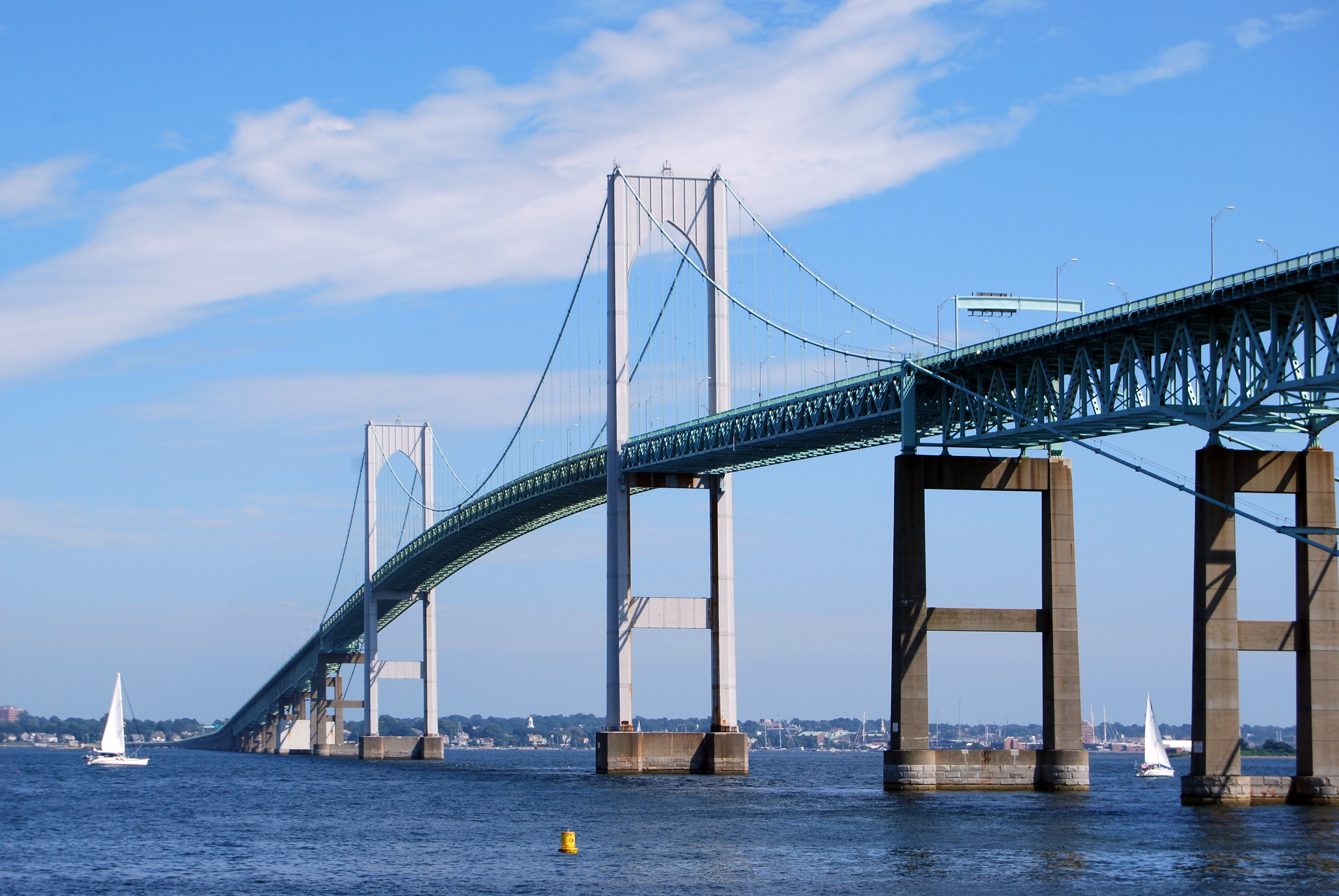
English: The Claiborne Pell Newport Bridge in Newport, Rhode Island, United States, a suspension bridge that connects Newport and Jamestown, crossing the Narragansett Bay. It was built in 1969 and is featured on the reverse of the Rhode Island quarter. |
| Date | |
| Source | Own work |
| Author | UpstateNYer |
| Camera location | 41° 30′ 29.63″ N, 71° 21′ 28.83″ W | View this and other nearby images on: OpenStreetMap |
|---|
 |
This image or media was taken or created by Matt H. Wade. To see his entire portfolio, click here. @thatmattwade
|
Licensing
I, the copyright holder of this work, hereby publish it under the following license:
This file is licensed under the Creative Commons Attribution-Share Alike 3.0 Unported license.
- You are free:
- to share – to copy, distribute and transmit the work
- to remix – to adapt the work
- Under the following conditions:
- attribution – You must give appropriate credit, provide a link to the license, and indicate if changes were made. You may do so in any reasonable manner, but not in any way that suggests the licensor endorses you or your use.
- share alike – If you remix, transform, or build upon the material, you must distribute your contributions under the same or compatible license as the original.
Captions
Add a one-line explanation of what this file represents
Items portrayed in this file
depicts
10 August 2009
41°30'29.632"N, 71°21'28.829"W
image/jpeg
ec9f754025c9e7d6e3bf600a0b34d910a1799c20
5,471,185 byte
2,592 pixel
3,872 pixel
File history
Click on a date/time to view the file as it appeared at that time.
| Date/Time | Thumbnail | Dimensions | User | Comment | |
|---|---|---|---|---|---|
| current | 03:28, 13 August 2009 | | 3,872 × 2,592 (5.22 MB) | MattWade | {{Information |Description={{en|1=The en:Claiborne Pell Newport Bridge in Newport, en:Rhode Island, en:United States, a en:suspension bridge that connects Newport and [[:en:Jamestown, Rhode Island|Jame |
File usage
The following pages on the English Wikipedia use this file (pages on other projects are not listed):
- 1989 Narragansett Bay oil spill
- Aquidneck Island
- Blackstone River
- Bristol, Rhode Island
- Bristol Ferry Light
- Camp Endicott
- Claiborne Pell Newport Bridge
- Coasters Harbor Island
- Conanicut Island
- Cornelius Island
- Cranston, Rhode Island
- Davisville, Rhode Island
- Despair Island
- Dutch Island (Rhode Island)
- Dyer Island (Rhode Island)
- East Greenwich, Rhode Island
- Fort Adams State Park
- Fort Hamilton Historic District
- Fox Island (Rhode Island)
- Goat Island (Rhode Island)
- Gould Island (Rhode Island)
- Greene Island (Rhode Island)
- Greenwich Bay (Rhode Island)
- Harbor Defenses of Narragansett Bay
- Hog Island (Rhode Island)
- Hog Island Shoal Light
- Hope Island (Rhode Island)
- IYRS School of Technology & Trades
- Ida Lewis Rock Light
- Jamestown, Rhode Island
- Jamestown Bridge
- Jamestown Verrazzano Bridge
- Lime Rock (island)
- List of bridges in the United States
- Little Compton, Rhode Island
- Middletown, Rhode Island
- Mount Hope Bridge
- Narragansett, Rhode Island
- Narragansett Bay
- Naval Station Newport
- Nayatt Point Light
- Newport, Rhode Island
- Newport Harbor Light
- North Kingstown, Rhode Island
- Patience Island
- Pawtuxet River
- Point Judith, Rhode Island
- Point Judith Light
- Portsmouth, Rhode Island
- Providence, Rhode Island
- Providence River
- Prudence Island
- Quonset Point
- Quonset Point Air National Guard Station
- Rabbit Island (Rhode Island)
- Rhode Island Route 138
- Rock Island (Rhode Island)
- Rose Island (Rhode Island)
- Rose Island Light
- Sakonnet River
- Sakonnet River Bridge
- Sakonnet River rail bridge
- Seekonk River
- Starvegoat Island
- Stone Bridge (Rhode Island)
- Taunton River
- Timeline of Newport, Rhode Island
- Tiverton, Rhode Island
- Warwick, Rhode Island
- Whale Rock
- Whale Rock Light
- Wickford Harbor Light
- Talk:List of longest suspension bridge spans/Archive 3
- Template:Narragansett Bay
- Category:Lighthouses in Newport County, Rhode Island
- Category:Tributaries of Providence River
- Portal:Rhode Island/Selected picture
- Portal:Rhode Island/Selected picture/19
Global file usage
The following other wikis use this file:
- Usage on an.wikipedia.org
- Usage on arz.wikipedia.org
- Usage on bat-smg.wikipedia.org
- Usage on be.wikipedia.org
- Usage on br.wikipedia.org
- Usage on cy.wikipedia.org
- Usage on de.wikipedia.org
- Usage on el.wikipedia.org
- Usage on en.wikivoyage.org
- Usage on es.wikipedia.org
- Usage on et.wikipedia.org
- Usage on eu.wikipedia.org
- Usage on fi.wikipedia.org
- Usage on fo.wikipedia.org
- Usage on fr.wikipedia.org
- Usage on fy.wikipedia.org
- Usage on ga.wikipedia.org
- Usage on gd.wikipedia.org
- Usage on haw.wikipedia.org
- Usage on hif.wikipedia.org
- Usage on hu.wikipedia.org
- Usage on ig.wikipedia.org
- Usage on is.wikipedia.org
- Usage on ja.wikipedia.org
- Usage on kn.wikipedia.org
- Usage on la.wikipedia.org
- Usage on lb.wikipedia.org
- Usage on mk.wikipedia.org
- Usage on ml.wikipedia.org
- Usage on ms.wikipedia.org
- Usage on nl.wikipedia.org
- Usage on pam.wikipedia.org
- Usage on sc.wikipedia.org
- Usage on se.wikipedia.org
- Usage on sk.wikipedia.org
- Usage on th.wikipedia.org
- Usage on tt.wikipedia.org
- Usage on uz.wikipedia.org
View more global usage of this file.
Metadata
This file contains additional information, probably added from the digital camera or scanner used to create or digitize it.
If the file has been modified from its original state, some details may not fully reflect the modified file.
| Camera manufacturer | NIKON CORPORATION |
|---|---|
| Camera model | NIKON D60 |
| Exposure time | 1/250 sec (0.004) |
| F-number | f/10 |
| ISO speed rating | 110 |
| Date and time of data generation | 13:52, 10 August 2009 |
| Lens focal length | 55 mm |
| Orientation | Normal |
| Horizontal resolution | 300 dpi |
| Vertical resolution | 300 dpi |
| Software used | Adobe Photoshop CS4 Macintosh |
| File change date and time | 23:23, 12 August 2009 |
| Y and C positioning | Co-sited |
| Exposure Program | Not defined |
| Exif version | 2.21 |
| Date and time of digitizing | 13:52, 10 August 2009 |
| Image compression mode | 4 |
| Exposure bias | 0 |
| Maximum land aperture | 5 APEX (f/5.66) |
| Metering mode | Pattern |
| Light source | Unknown |
| Flash | Flash did not fire, compulsory flash suppression |
| DateTime subseconds | 30 |
| DateTimeOriginal subseconds | 30 |
| DateTimeDigitized subseconds | 30 |
| Color space | sRGB |
| Sensing method | One-chip color area sensor |
| Custom image processing | Normal process |
| Exposure mode | Auto exposure |
| White balance | Auto white balance |
| Digital zoom ratio | 1 |
| Focal length in 35 mm film | 82 mm |
| Scene capture type | Landscape |
| Contrast | Hard |
| Saturation | Normal |
| Sharpness | Hard |
| Subject distance range | Unknown |
Retrieved from "https://en.wikipedia.org/wiki/File:Claiborne_Pell_Newport_Bridge.jpg"