File:Relief_map_of_Bahamas.png
From Wikipedia, the free encyclopedia
No higher resolution available.
Relief_map_of_Bahamas.png (780 × 562 pixels, file size: 288 KB, MIME type: image/png)
| This is a file from the Wikimedia Commons. Information from its description page there is shown below. Commons is a freely licensed media file repository. You can help. |
Summary
| DescriptionRelief map of Bahamas.png |
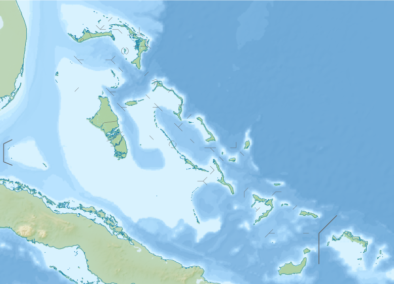
Русский: Физическая карта Багам.
English: Relief map of the Bahamas
Equirectangular projection, N/S stretching 105 %. Geographic limits of the map:
|
| Date | |
| Source |
|
| Author | Nzeemin |
| Other versions |
|

Licensing
I, the copyright holder of this work, hereby publish it under the following license:
This file is licensed under the Creative Commons Attribution-Share Alike 3.0 Unported license.
- You are free:
- to share – to copy, distribute and transmit the work
- to remix – to adapt the work
- Under the following conditions:
- attribution – You must give appropriate credit, provide a link to the license, and indicate if changes were made. You may do so in any reasonable manner, but not in any way that suggests the licensor endorses you or your use.
- share alike – If you remix, transform, or build upon the material, you must distribute your contributions under the same or compatible license as the original.
Captions
Add a one-line explanation of what this file represents
Items portrayed in this file
depicts
20 November 2012
image/png
File history
Click on a date/time to view the file as it appeared at that time.
| Date/Time | Thumbnail | Dimensions | User | Comment | |
|---|---|---|---|---|---|
| current | 19:06, 20 November 2012 | | 780 × 562 (288 KB) | Nzeemin | User created page with UploadWizard |
File usage
The following pages on the English Wikipedia use this file (pages on other projects are not listed):
- Abaco Islands
- Bahamas National Open
- Baker's Bay
- Cargill Creek
- Dean's Blue Hole
- Deep Creek (Bahamas)
- Exuma Sound
- Goose River (Bahamas)
- Grotto Beach Formation
- Hawk Creek (Bahamas)
- Hero World Challenge
- Jamaa' Ahlus Sunnah Bahamas Mosque
- Lake Cunningham (Bahamas)
- Lake Killarney (Bahamas)
- Lisbon Creek
- List of fossiliferous stratigraphic units in the Caribbean
- Little Grassy Creek
- Loggerhead Creek
- Lucayan Formation
- Man-O-War Cay
- Mount Alvernia
- Mount Creek
- Nassau, Bahamas
- Nicholas Channel
- Old Bahama Channel
- Paradise Island
- Pelican Creek (Bahamas)
- Pure Silk-Bahamas LPGA Classic
- River Lees
- Sandy Creek (Bahamas)
- Sapodilla Creek
- Sea of Abaco
- Simon Creek
- Somerset Creek
- St. Francis Xavier Cathedral, Nassau
- Staniard Creek
- Starve Creek
- The Bahamas Great Abaco Classic
- The Bahamas Great Exuma Classic
- Timber Creek (Bahamas)
- Treasure Cay
- West End Classic
- Module:Location map/data/Bahamas
- Module:Location map/data/Bahamas/doc
Global file usage
The following other wikis use this file:
- Usage on als.wikipedia.org
- Usage on ar.wikipedia.org
- Usage on ast.wikipedia.org
- Usage on az.wikipedia.org
- Şablon:Yer xəritəsi Baham adaları
- San Salvador adası
- Abako adaları
- Aklins
- Andros (Baham adaları)
- Böyük Bahama
- Volkers-Ki
- Qreyt-Raqqed-Aylend
- Co-Kis
- İnaqua
- Kruked-Aylend (Baham adaları)
- Ket-Aylend (Baham adaları)
- Mayaquana
- Normans-Key
- Nyu-Providens
- Eksuma
- Elütera
- Eqq-Aylend (Baham adaları)
- Sil-Ki
- Ram-Ki
- Qrand-Ki adası
- Kastavey-Ki
- Piq-Biç
- Berri adaları
- Litl-Stirrap-Ki
- Usage on bar.wikipedia.org
- Usage on be.wikipedia.org
- Usage on bg.wikipedia.org
- Usage on bn.wikipedia.org
- Usage on bs.wikipedia.org
- Usage on ceb.wikipedia.org
- Usage on cs.wikipedia.org
View more global usage of this file.
Metadata
This file contains additional information, probably added from the digital camera or scanner used to create or digitize it.
If the file has been modified from its original state, some details may not fully reflect the modified file.
| Horizontal resolution | 17.72 dpc |
|---|---|
| Vertical resolution | 17.72 dpc |
| Software used |
Retrieved from "https://en.wikipedia.org/wiki/File:Relief_map_of_Bahamas.png"