File:USSR_map_NL_55-10_Rausu.jpg
From Wikipedia, the free encyclopedia
Size of this preview: 779 × 599 pixels. Other resolutions: 312 × 240 pixels | 624 × 480 pixels | 998 × 768 pixels | 1,280 × 985 pixels | 2,560 × 1,970 pixels | 5,000 × 3,847 pixels.
Original file (5,000 × 3,847 pixels, file size: 2.94 MB, MIME type: image/jpeg)
| This is a file from the Wikimedia Commons. Information from its description page there is shown below. Commons is a freely licensed media file repository. You can help. |
Summary
| DescriptionUSSR map NL 55-10 Rausu.jpg |
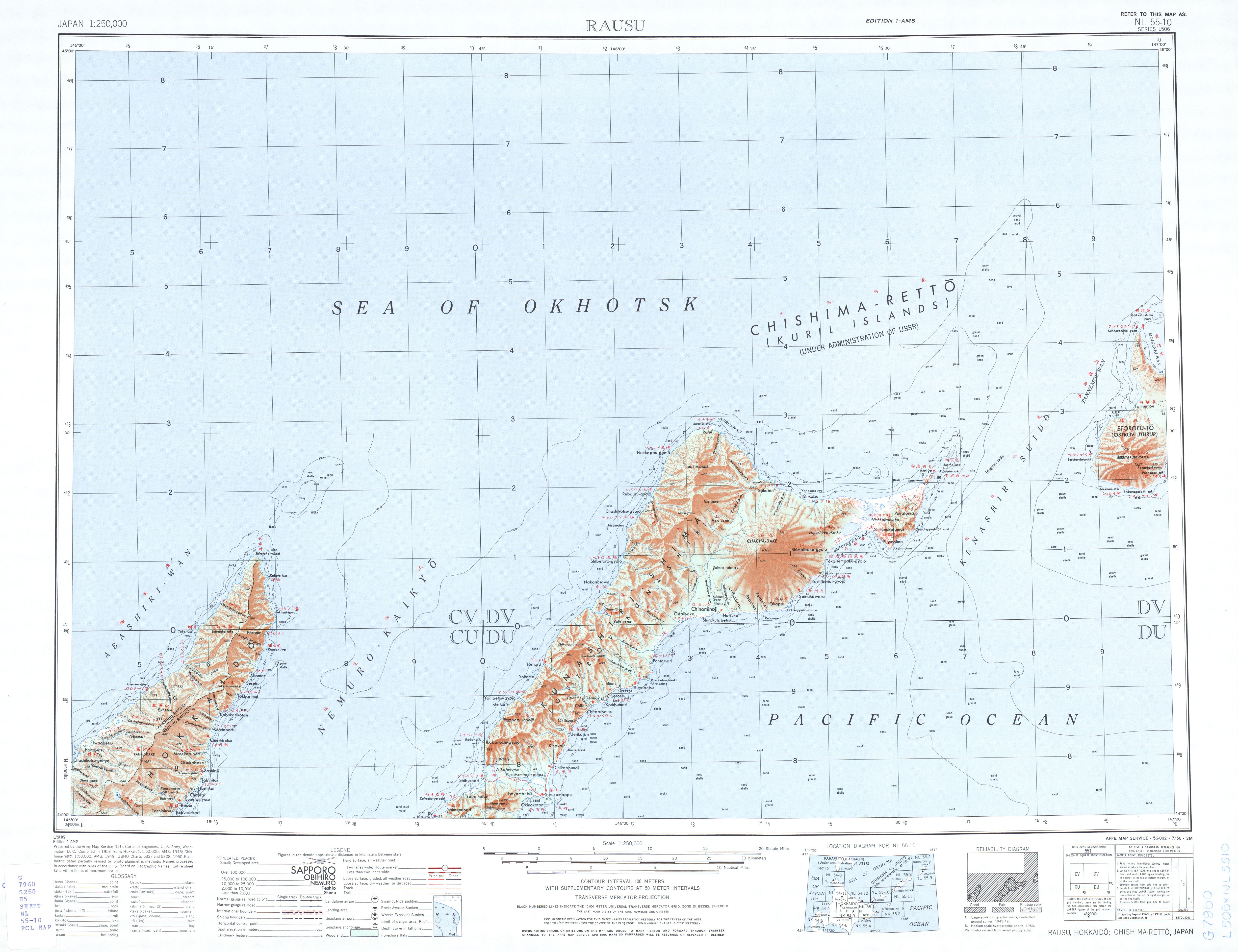
English: List from Japan AMS Topographic Maps. Series L506, U.S. Army Map Service, "compiled" in 1953; Iturup, Kunashir, Nemuro Strait, Shiretoko Peninsula
Русский: Лист из набора карт Японии Картографической военной службы США. Серия 506. 1953; Итуруп, Кунашир, Кунаширский пролив, Сиретоко
This file was uploaded with Commonist. |
| Date | |
| Source | The University of Texas libraries |
| Author |
English: U.S. Army Map Service |
Licensing
| Public domainPublic domainfalsefalse |
This file is a work of a U.S. Army soldier or employee, taken or made as part of that person's official duties. As a work of the U.S. federal government, it is in the public domain in the United States.
العربية ∙ বাংলা ∙ català ∙ čeština ∙ Deutsch ∙ English ∙ español ∙ eesti ∙ فارسی ∙ suomi ∙ français ∙ hrvatski ∙ magyar ∙ Bahasa Indonesia ∙ italiano ∙ 日本語 ∙ 한국어 ∙ lietuvių ∙ македонски ∙ മലയാളം ∙ မြန်မာဘာသာ ∙ Nederlands ∙ polski ∙ português ∙ русский ∙ sicilianu ∙ српски / srpski ∙ Türkçe ∙ українська ∙ Tiếng Việt ∙ 中文(简体) ∙ 中文(繁體) ∙ +/− |
 |
Captions
Add a one-line explanation of what this file represents
Items portrayed in this file
depicts
1953
File history
Click on a date/time to view the file as it appeared at that time.
| Date/Time | Thumbnail | Dimensions | User | Comment | |
|---|---|---|---|---|---|
| current | 20:15, 25 September 2011 | | 5,000 × 3,847 (2.94 MB) | Doff |
File usage
No pages on the English Wikipedia use this file (pages on other projects are not listed).
Global file usage
Metadata
This file contains additional information, probably added from the digital camera or scanner used to create or digitize it.
If the file has been modified from its original state, some details may not fully reflect the modified file.
| _error | 0 |
|---|
Retrieved from "https://en.wikipedia.org/wiki/File:USSR_map_NL_55-10_Rausu.jpg"