File:Unitary_Plan_Wind_Tunnel_aerial.jpeg
From Wikipedia, the free encyclopedia
No higher resolution available.
Unitary_Plan_Wind_Tunnel_aerial.jpeg (650 × 512 pixels, file size: 80 KB, MIME type: image/jpeg)
| This is a file from the Wikimedia Commons. Information from its description page there is shown below. Commons is a freely licensed media file repository. You can help. |
|
This is an image of a place or building that is listed on the National Register of Historic Places in the United States of America. Its reference number is 85002799. |
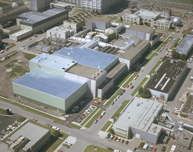
| DescriptionUnitary Plan Wind Tunnel aerial.jpeg | Aerial view of the Unitary Plan Wind Tunnel complex, NASA Ames Research Center, Mountain View, California, USA | ||||||
| Date | |||||||
| Source | http://ails.arc.nasa.gov/Images/Ames/AC74-1400.html | ||||||
| Author | Art Melliar, NASA | ||||||
| Permission (Reusing this file) |
|

| Object location | 37° 25′ 03″ N, 122° 03′ 35″ W | View this and other nearby images on: OpenStreetMap |
|---|
Captions
Add a one-line explanation of what this file represents
Items portrayed in this file
depicts
1974
37°25'3.0"N, 122°3'34.9"W
image/jpeg
File history
Click on a date/time to view the file as it appeared at that time.
| Date/Time | Thumbnail | Dimensions | User | Comment | |
|---|---|---|---|---|---|
| current | 19:59, 13 March 2007 | | 650 × 512 (80 KB) | Holly Cheng | {{Information |Description=Aerial view of the w:Unitary Plan Wind Tunnel complex, NASA Ames Research Center, Mountain View, California, USA |Source=http://ails.arc.nasa.gov/Images/Ames/AC74-1400.html |Date=1974 |Author=Art Melliar, NASA |Permission={ |
File usage
The following pages on the English Wikipedia use this file (pages on other projects are not listed):
Metadata
This file contains additional information, probably added from the digital camera or scanner used to create or digitize it.
If the file has been modified from its original state, some details may not fully reflect the modified file.
| _error | 0 |
|---|