File:Abbasids850.png
From Wikipedia, the free encyclopedia
Size of this preview: 800 × 487 pixels. Other resolutions: 320 × 195 pixels | 640 × 390 pixels | 1,024 × 624 pixels | 1,481 × 902 pixels.
Original file (1,481 × 902 pixels, file size: 50 KB, MIME type: image/png)
| This is a file from the Wikimedia Commons. Information from its description page there is shown below. Commons is a freely licensed media file repository. You can help. |
Summary
| DescriptionAbbasids850.png |
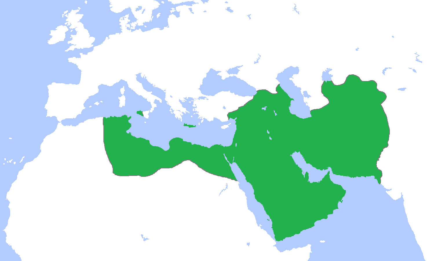
English: Map of the Abbasid Caliphate at its greatest extent, c. 850.
(Partially based on Atlas of World History (2007) - Progress of Islam, map)
العربية: :خريطة الدولة العباسية في أقصى اتساعها. |
| Date | |
| Source | Own work |
| Author | Gabagool |
| Other versions | Derivative works of this file: IslamicWorld850.png |

|
File:Abbassids 850 (orthographic projection).svg is a vector version of this file. It should be used in place of this PNG file when not inferior.
File:Abbasids850.png → File:Abbassids 850 (orthographic projection).svg
For more information, see Help:SVG.
|
.svg) |
Licensing
I, the copyright holder of this work, hereby publish it under the following license:
This file is licensed under the Creative Commons Attribution 3.0 Unported license.
- You are free:
- to share – to copy, distribute and transmit the work
- to remix – to adapt the work
- Under the following conditions:
- attribution – You must give appropriate credit, provide a link to the license, and indicate if changes were made. You may do so in any reasonable manner, but not in any way that suggests the licensor endorses you or your use.
Captions
Add a one-line explanation of what this file represents
نقشه خلافت عباسی در بزرگترین گستره آن، ۸۵۰م. (تا حدی بر اساس اطلس تاریخ جهان (۲۰۰۷) - پیشرفت اسلام، نقشه)
خريطة الدولة العباسية في أقصى اتساعها.
Items portrayed in this file
depicts
21 April 2009
image/png
37d11d5e8705bcd600059a55fdab1ddc8c190a05
51,274 byte
902 pixel
1,481 pixel
File history
Click on a date/time to view the file as it appeared at that time.
| Date/Time | Thumbnail | Dimensions | User | Comment | |
|---|---|---|---|---|---|
| current | 10:42, 25 March 2012 | | 1,481 × 902 (50 KB) | Cplakidas | corrections: the eastern half of Sicily was still in Byz. hands, as was Malta. Sardinia and Corsica were raided but never conquered |
| 15:28, 22 April 2009 |  | 1,481 × 902 (50 KB) | Gabagool | some corrections.. | |
| 16:28, 21 April 2009 |  | 1,481 × 902 (50 KB) | Gabagool | {{Information |Description={{en|1=Map of the Abbasid Caliphat at its greatest extent, c. 850. (Partially based on ''Atlas of World History'' (2007) - Progress of Islam, map)}} |Source=Own work by uploader |Author=Gabagool / Jarle Grøhn |
File usage
The following pages on the English Wikipedia use this file (pages on other projects are not listed):
- Abbasid architecture
- Al-Mutawakkil
- Anarchy at Samarra
- History of Iraq
- History of Islam
- History of Qatar
- Qatar
- Science in the medieval Islamic world
- Talk:Abbasid Caliphate/Archive 1
- User:BomBom/List of caliphs
- User:Falcaorib
- User:Kansas Bear/Saffarid dynasty
- User:Nosam123/sandbox
- User:Sobreira/Religion
- Portal:History of science
- Portal:Iraq
Global file usage
The following other wikis use this file:
- Usage on af.wikipedia.org
- Usage on als.wikipedia.org
- Usage on an.wikipedia.org
- Usage on ar.wikipedia.org
- Usage on arz.wikipedia.org
- Usage on ast.wikipedia.org
- Usage on azb.wikipedia.org
- Usage on bat-smg.wikipedia.org
- Usage on be-tarask.wikipedia.org
- Usage on be.wikipedia.org
- Usage on bg.wikipedia.org
- Usage on bn.wikipedia.org
- Usage on br.wikipedia.org
- Usage on bs.wikipedia.org
- Usage on bxr.wikipedia.org
- Usage on ca.wikipedia.org
- Usage on cbk-zam.wikipedia.org
- Usage on ckb.wikipedia.org
- Usage on cs.wikipedia.org
- Usage on da.wikipedia.org
- Usage on de.wikipedia.org
- Usage on diq.wikipedia.org
- Usage on eo.wikipedia.org
View more global usage of this file.
Retrieved from "https://en.wikipedia.org/wiki/File:Abbasids850.png"