File:Acaxee_location.jpg
From Wikipedia, the free encyclopedia
No higher resolution available.
Acaxee_location.jpg (800 × 523 pixels, file size: 32 KB, MIME type: image/jpeg)
| This is a file from the Wikimedia Commons. Information from its description page there is shown below. Commons is a freely licensed media file repository. You can help. |
| DescriptionAcaxee location.jpg |
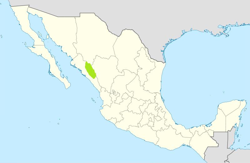
English: Map of Mexico, with states borders. Español: Mapa de Mexico, con los límites de los estados. Français : Carte du Mexique, avec les limites des états. |
| Date | (UTC) |
| Source | |
| Author |
|
| This is a retouched picture, which means that it has been digitally altered from its original version. Modifications: Showing location of Acaxee Indians. The original can be viewed here: Mexico States blank map.svg:
|
I, the copyright holder of this work, hereby publish it under the following licenses:
This file is licensed under the Creative Commons Attribution-Share Alike 3.0 Unported, 2.5 Generic, 2.0 Generic and 1.0 Generic license.
- You are free:
- to share – to copy, distribute and transmit the work
- to remix – to adapt the work
- Under the following conditions:
- attribution – You must give appropriate credit, provide a link to the license, and indicate if changes were made. You may do so in any reasonable manner, but not in any way that suggests the licensor endorses you or your use.
- share alike – If you remix, transform, or build upon the material, you must distribute your contributions under the same or compatible license as the original.

|
Permission is granted to copy, distribute and/or modify this document under the terms of the GNU Free Documentation License, Version 1.2 or any later version published by the Free Software Foundation; with no Invariant Sections, no Front-Cover Texts, and no Back-Cover Texts. A copy of the license is included in the section entitled GNU Free Documentation License.http://www.gnu.org/copyleft/fdl.htmlGFDLGNU Free Documentation Licensetruetrue |
You may select the license of your choice.
Original upload log
This image is a derivative work of the following images:
- File:Mexico_States_blank_map.svg licensed with Cc-by-sa-3.0,2.5,2.0,1.0, GFDL
- 2010-08-13T15:41:57Z Kmusser 2029x1326 (484650 Bytes) Try that again
- 2010-08-13T15:41:09Z Kmusser 975x654 (369458 Bytes) change projection to match that used at File:Mexico location map.svg so should be more accurate for pushpins, also reverted Yucatan boundary change to match Mexican government maps.
- 2009-05-25T11:58:07Z Sémhur 975x654 (369458 Bytes) Modify border south between Quintana Roo and Campeche
- 2009-05-24T08:31:40Z Sémhur 975x654 (369191 Bytes) Adding Yucatan states
- 2008-09-24T12:57:13Z Sémhur 975x654 (337956 Bytes) new try
- 2008-09-24T12:40:07Z Sémhur 975x654 (335678 Bytes) Thiner strokes
- 2008-09-24T12:37:33Z Sémhur 975x654 (335680 Bytes) {{Information |Description= {{en|Map of Mexico, with states borders.}} {{es|Mapa de Mexico, con los límites de los estados.}} {{fr|Carte du Mexique, avec les limites des états.}} |Source=Travail personnel / Own work. Source
Uploaded with derivativeFX
Captions
Add a one-line explanation of what this file represents
Items portrayed in this file
depicts
image/jpeg
6de5f29d3f9b94d33a2a82ffce83903d468ea71b
32,313 byte
523 pixel
800 pixel
File history
Click on a date/time to view the file as it appeared at that time.
| Date/Time | Thumbnail | Dimensions | User | Comment | |
|---|---|---|---|---|---|
| current | 13:28, 3 February 2011 | | 800 × 523 (32 KB) | Smallchief | {{Information |Description={{en|Map of Mexico, with states borders.}} {{es|Mapa de Mexico, con los límites de los estados.}} {{fr|Carte du Mexique, avec les limites des états.}} |Source=*File:Mexico_States_blank_map.svg |Date=2011-02-03 13:25 (UTC |
File usage
The following pages on the English Wikipedia use this file (pages on other projects are not listed):
Global file usage
The following other wikis use this file:
- Usage on de.wikipedia.org
- Usage on es.wikipedia.org
- Usage on fr.wikipedia.org
- Usage on hr.wikipedia.org
- Usage on www.wikidata.org
Metadata
This file contains additional information, probably added from the digital camera or scanner used to create or digitize it.
If the file has been modified from its original state, some details may not fully reflect the modified file.
| File change date and time | 15:41, 13 August 2010 |
|---|
Retrieved from "https://en.wikipedia.org/wiki/File:Acaxee_location.jpg"