File:As_an_extremely_low-lying_country,_surrounded_by_vast_oceans,_Kiribati_is_at_risk_from_the_negative_effects_of_climate_change,_such_as_sea-level_rise_and_storm_surges,_2011._Photo-_Erin_Magee_-_DFAT_(12426392094).jpg
From Wikipedia, the free encyclopedia
Size of this preview: 800 × 533 pixels. Other resolutions: 320 × 213 pixels | 640 × 427 pixels | 1,024 × 682 pixels | 1,280 × 853 pixels | 2,590 × 1,726 pixels.
Original file (2,590 × 1,726 pixels, file size: 1.46 MB, MIME type: image/jpeg)
| This is a file from the Wikimedia Commons. Information from its description page there is shown below. Commons is a freely licensed media file repository. You can help. |
Summary
| DescriptionAs an extremely low-lying country, surrounded by vast oceans, Kiribati is at risk from the negative effects of climate change, such as sea-level rise and storm surges, 2011. Photo- Erin Magee - DFAT (12426392094).jpg |
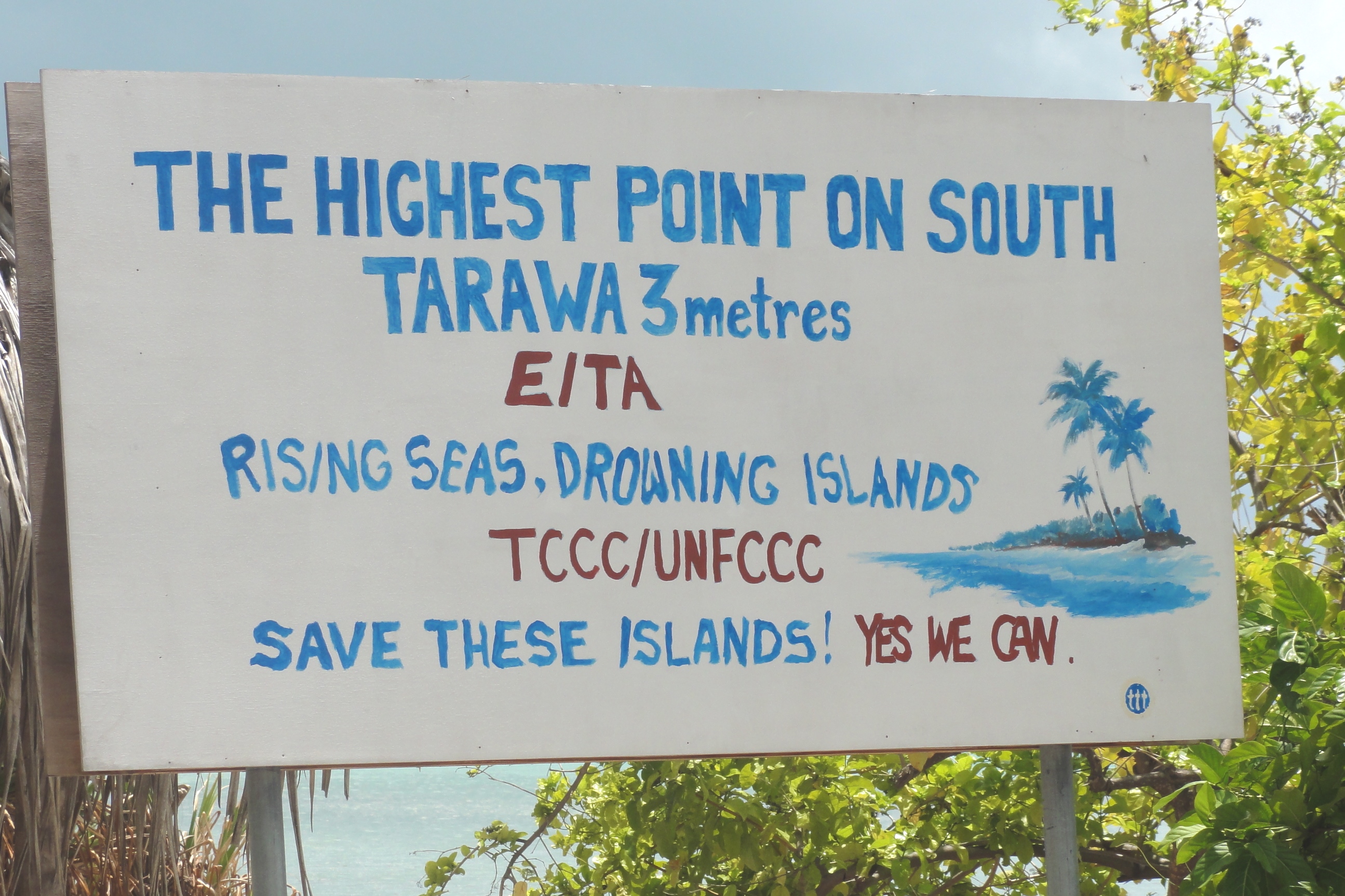
English: As an extremely low-lying country, surrounded by vast oceans, Kiribati is at risk from the negative effects of climate change, such as sea-level rise and storm surges, 2011. Photo: Erin Magee / DFAT. |
| Date | |
| Source | As an extremely low-lying country, surrounded by vast oceans, Kiribati is at risk from the negative effects of climate change, such as sea-level rise and storm surges, 2011. Photo: Erin Magee / DFAT |
| Author | Erin Magee/DFAT |
| Camera location | 1° 21′ 49.02″ N, 173° 05′ 07.86″ E | View this and other nearby images on: OpenStreetMap |
|---|
Licensing
This file is licensed under the Creative Commons Attribution 2.0 Generic license.
Attribution: Erin Magee/DFAT
- You are free:
- to share – to copy, distribute and transmit the work
- to remix – to adapt the work
- Under the following conditions:
- attribution – You must give appropriate credit, provide a link to the license, and indicate if changes were made. You may do so in any reasonable manner, but not in any way that suggests the licensor endorses you or your use.
| This image was originally posted to Flickr by DFAT photo library at https://www.flickr.com/photos/106853342@N04/12426392094. It was reviewed on 14 April 2014 by FlickreviewR and was confirmed to be licensed under the terms of the cc-by-2.0. |
14 April 2014
Captions
Add a one-line explanation of what this file represents
Items portrayed in this file
depicts
17 April 2011
1°21'49.018"N, 173°5'7.858"E
0.004 second
11
25.96 millimetre
125
image/jpeg
a93a52c0064a2c7e0931b14f362ef344c6b725cc
1,529,615 byte
1,726 pixel
2,590 pixel
File history
Click on a date/time to view the file as it appeared at that time.
| Date/Time | Thumbnail | Dimensions | User | Comment | |
|---|---|---|---|---|---|
| current | 05:58, 14 April 2014 | | 2,590 × 1,726 (1.46 MB) | Russavia | Transferred from Flickr via Flickr2commons |
File usage
The following pages on the English Wikipedia use this file (pages on other projects are not listed):
Global file usage
The following other wikis use this file:
- Usage on ig.wikipedia.org
- Usage on sv.wikipedia.org
- Usage on zh.wikipedia.org
Metadata
This file contains additional information, probably added from the digital camera or scanner used to create or digitize it.
If the file has been modified from its original state, some details may not fully reflect the modified file.
| Image title |
|
|---|---|
| Camera manufacturer | SONY |
| Camera model | DSC-HX5V |
| Exposure time | 1/250 sec (0.004) |
| F-number | f/11 |
| ISO speed rating | 125 |
| Date and time of data generation | 06:21, 17 April 2011 |
| Lens focal length | 25.96 mm |
| Latitude | 1° 21′ 49.02″ N |
| Longitude | 173° 5′ 7.86″ E |
| Altitude | 120.6 meters above sea level |
| Short title |
|
| Orientation | Normal |
| File change date and time | 06:21, 17 April 2011 |
| Y and C positioning | Co-sited |
| Exposure Program | Normal program |
| Exif version | 2.21 |
| Date and time of digitizing | 06:21, 17 April 2011 |
| Meaning of each component |
|
| Image compression mode | 5 |
| Exposure bias | 0 |
| Maximum land aperture | 3.625 APEX (f/3.51) |
| Metering mode | Pattern |
| Light source | Unknown |
| Flash | Flash did not fire, auto mode |
| DateTimeOriginal subseconds | 00 |
| DateTimeDigitized subseconds | 00 |
| Supported Flashpix version | 1 |
| Color space | sRGB |
| File source | Digital still camera |
| Scene type | A directly photographed image |
| Custom image processing | Normal process |
| Exposure mode | Auto exposure |
| White balance | Auto white balance |
| Scene capture type | Landscape |
| Contrast | Normal |
| Saturation | Normal |
| Sharpness | Normal |
| GPS time (atomic clock) | 00:47 |
| Receiver status | Measurement interoperability |
| Measurement mode | 2-dimensional measurement |
| Speed unit | Kilometers per hour |
| Speed of GPS receiver | 7.7 |
| Reference for direction of movement | True direction |
| Direction of movement | 244.63 |
| Reference for direction of image | Magnetic direction |
| Direction of image | 205.25 |
| Geodetic survey data used | WGS-84 |
| GPS date | 17 April 2011 |
| GPS differential correction | 0 |
| GPS tag version | 2.2.0.0 |
.jpg)