File:Be-map-de.png
From Wikipedia, the free encyclopedia
No higher resolution available.
Be-map-de.png (329 × 353 pixels, file size: 15 KB, MIME type: image/png)
| This is a file from the Wikimedia Commons. Information from its description page there is shown below. Commons is a freely licensed media file repository. You can help. |
Summary
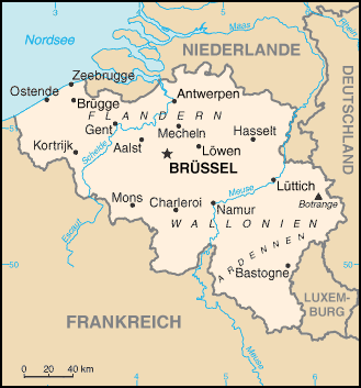
| DescriptionBe-map-de.png |
Deutsch: Karte von Belgien
English: Map of Belgium |
||||
| Date | |||||
| Source | |||||
| Author | NordNordWest | ||||
| Permission (Reusing this file) |
|

Captions
Add a one-line explanation of what this file represents
Items portrayed in this file
depicts
28 March 2011
image/png
cb1b72dbadef91317b54e2c7f591f149288e3d47
15,523 byte
353 pixel
329 pixel
File history
Click on a date/time to view the file as it appeared at that time.
| Date/Time | Thumbnail | Dimensions | User | Comment | |
|---|---|---|---|---|---|
| current | 16:49, 28 March 2011 | | 329 × 353 (15 KB) | NordNordWest | == {{int:filedesc}} == {{Information |Description= {{de|Karte von Belgien}} {{en|Map of Belgium}} |Source= * file:Be-map.png * file:BE-REDU-map.png |Date=2011-03-28 |Author={{U|NordNordWest}} |Permission={{PD-USGov-CIA-WF}} |other_versions= }} |
File usage
No pages on the English Wikipedia use this file (pages on other projects are not listed).
Global file usage
The following other wikis use this file:
- Usage on de.wikipedia.org
- Usage on nds.wikipedia.org
- Usage on pfl.wikipedia.org
- Usage on pnb.wikipedia.org
Retrieved from "https://en.wikipedia.org/wiki/File:Be-map-de.png"