File:Bognor_Regis_-_geograph.org.uk_-_537839.jpg
From Wikipedia, the free encyclopedia
No higher resolution available.
Bognor_Regis_-_geograph.org.uk_-_537839.jpg (640 × 480 pixels, file size: 68 KB, MIME type: image/jpeg)
| This is a file from the Wikimedia Commons. Information from its description page there is shown below. Commons is a freely licensed media file repository. You can help. |
Summary
| DescriptionBognor Regis - geograph.org.uk - 537839.jpg |
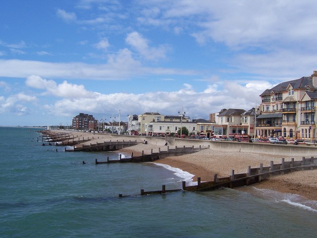
English: Bognor Regis Taken from the Pier. |
| Date | |
| Source | From geograph.org.uk |
| Author | Pam Goodey |
| Attribution (required by the license) InfoField | Pam Goodey / Bognor Regis / |
InfoField | Pam Goodey / Bognor Regis |
| Camera location | 50° 46′ 49″ N, 0° 40′ 33″ W | View this and other nearby images on: OpenStreetMap |
|---|
| Object location | 50° 46′ 50″ N, 0° 40′ 44″ W | View this and other nearby images on: OpenStreetMap |
|---|
Licensing

|
This image was taken from the Geograph project collection. See this photograph's page on the Geograph website for the photographer's contact details. The copyright on this image is owned by Pam Goodey and is licensed for reuse under the Creative Commons Attribution-ShareAlike 2.0 license.
|
This file is licensed under the Creative Commons Attribution-Share Alike 2.0 Generic license.
Attribution: Pam Goodey
- You are free:
- to share – to copy, distribute and transmit the work
- to remix – to adapt the work
- Under the following conditions:
- attribution – You must give appropriate credit, provide a link to the license, and indicate if changes were made. You may do so in any reasonable manner, but not in any way that suggests the licensor endorses you or your use.
- share alike – If you remix, transform, or build upon the material, you must distribute your contributions under the same or compatible license as the original.
- Remove redundant categories and try to put this image in the most specific category/categories
- Remove this template
- The location categories are based on information from this geonames tool and this OpenStreetMap tool combined with a database. You can also have a look at this tool from mysociety.
- The topic category from Geograph was Beach front (find similar images front at Geograph)
English | suomi | français | galego | עברית | magyar | македонски | മലയാളം | português | português do Brasil | Türkçe | +/−
Captions
View of coast westwards from Bornor Pier towards Pagham
Items portrayed in this file
depicts
some value
12 August 2007
50°46'49.4"N, 0°40'32.9"W
50°46'49.91"N, 0°40'44.40"W
image/jpeg
0226ecfdac9bb6490f6d7cc05630d04e4606397d
69,221 byte
480 pixel
640 pixel
File history
Click on a date/time to view the file as it appeared at that time.
| Date/Time | Thumbnail | Dimensions | User | Comment | |
|---|---|---|---|---|---|
| current | 19:15, 5 February 2011 | | 640 × 480 (68 KB) | GeographBot | == {{int:filedesc}} == {{Information |description={{en|1=Bognor Regis Taken from the Pier.}} |date=2007-08-12 |source=From [http://www.geograph.org.uk/photo/537839 geograph.org.uk] |author=[http://www.geograph.org.uk/profile/14802 Pam Goodey] |permission= |
File usage
The following pages on the English Wikipedia use this file (pages on other projects are not listed):
Global file usage
The following other wikis use this file:
- Usage on arz.wikipedia.org
- Usage on azb.wikipedia.org
- Usage on ca.wikipedia.org
- Usage on ceb.wikipedia.org
- Usage on cs.wikipedia.org
- Usage on cy.wikipedia.org
- Usage on de.wikivoyage.org
- Usage on en.wikivoyage.org
- Usage on eo.wikipedia.org
- Usage on fr.wikivoyage.org
- Usage on ga.wikipedia.org
- Usage on it.wikipedia.org
- Usage on ja.wikipedia.org
- Usage on lld.wikipedia.org
- Usage on lt.wikipedia.org
- Usage on lv.wikipedia.org
- Usage on no.wikipedia.org
- Usage on pt.wikipedia.org
- Usage on ro.wikipedia.org
- Usage on ru.wikipedia.org
- Usage on sr.wikipedia.org
- Usage on tt.wikipedia.org
- Usage on uk.wikipedia.org
- Usage on vo.wikipedia.org
- Usage on www.wikidata.org
- Usage on zh-min-nan.wikipedia.org
- Usage on zh.wikipedia.org
Metadata
This file contains additional information, probably added from the digital camera or scanner used to create or digitize it.
If the file has been modified from its original state, some details may not fully reflect the modified file.
| Camera manufacturer | EASTMAN KODAK COMPANY |
|---|---|
| Camera model | KODAK LS753 ZOOM DIGITAL CAMERA |
| Exposure time | 1/750 sec (0.0013333333333333) |
| F-number | f/4.8 |
| Date and time of data generation | 13:10, 12 August 2007 |
| Lens focal length | 6 mm |
| Orientation | Normal |
| Horizontal resolution | 230 dpi |
| Vertical resolution | 230 dpi |
| Y and C positioning | Centered |
| Exposure Program | Normal program |
| Exif version | 2.21 |
| Date and time of digitizing | 13:10, 12 August 2007 |
| Shutter speed | 9.5 |
| APEX aperture | 4.5 |
| Exposure bias | 0 |
| Maximum land aperture | 3.2 APEX (f/3.03) |
| Metering mode | Pattern |
| Light source | Unknown |
| Flash | Flash did not fire, auto mode |
| Color space | sRGB |
| Exposure index | 80 |
| Sensing method | One-chip color area sensor |
| Custom image processing | Normal process |
| Exposure mode | Auto exposure |
| White balance | Auto white balance |
| Digital zoom ratio | 0 |
| Focal length in 35 mm film | 36 mm |
| Scene capture type | Standard |
| Contrast | Normal |
| Saturation | Normal |
| Sharpness | Normal |
| Subject distance range | Unknown |