File:Bourke_County_1866.jpg
From Wikipedia, the free encyclopedia
Size of this preview: 744 × 599 pixels. Other resolutions: 298 × 240 pixels | 596 × 480 pixels | 953 × 768 pixels | 1,271 × 1,024 pixels | 2,412 × 1,943 pixels.
Original file (2,412 × 1,943 pixels, file size: 738 KB, MIME type: image/jpeg)
| This is a file from the Wikimedia Commons. Information from its description page there is shown below. Commons is a freely licensed media file repository. You can help. |
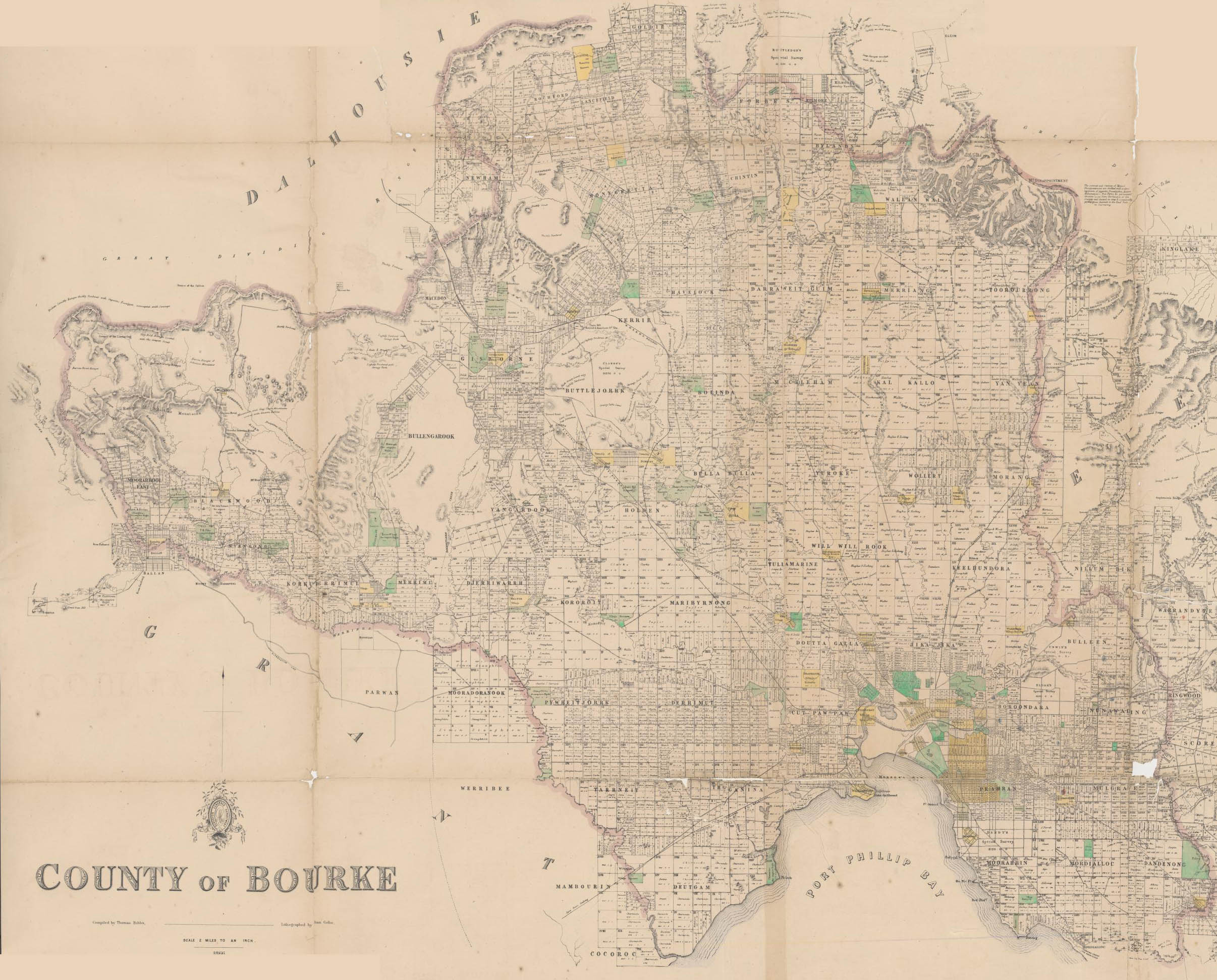
Map of Bourke County in 1866 from the National Library located here.
Title: County of Bourke [cartographic material] / compiled by Thomas Bibbs ; lithographed by William Collis ; Surveyor General's Department.
| Public domainPublic domainfalsefalse |
This image or other work is of Australian origin and is now in the public domain because its term of copyright has expired. According to the Australian Copyright Council (ACC), ACC Information Sheet G023v19 (Duration of copyright) (January 2019).1
When using this template, please provide information of where the image was first published and who created it. العربية ∙ català ∙ Deutsch ∙ English ∙ español ∙ français ∙ 日本語 ∙ македонски ∙ മലയാളം ∙ Nederlands ∙ русский ∙ slovenščina ∙ Tok Pisin ∙ Türkçe ∙ українська ∙ 简体中文 ∙ 繁體中文 ∙ +/− |
 | |||||||||||||||||||
Captions
Add a one-line explanation of what this file represents
Items portrayed in this file
depicts
image/jpeg
c20788ff0e983c0c87e49bec9fef4425496bbe0c
755,350 byte
1,943 pixel
2,412 pixel
File history
Click on a date/time to view the file as it appeared at that time.
| Date/Time | Thumbnail | Dimensions | User | Comment | |
|---|---|---|---|---|---|
| current | 10:29, 10 March 2007 | | 2,412 × 1,943 (738 KB) | Roke~commonswiki | Map of Bourke County in 1866 from the National Library located [http://nla.gov.au/nla.map-rm1009 here]. Title: County of Bourke [cartographic material] / compiled by Thomas Bibbs ; lithographed by William Collis ; Surveyor General's Department. [[Categ |
File usage
The following pages on the English Wikipedia use this file (pages on other projects are not listed):
Metadata
This file contains additional information, probably added from the digital camera or scanner used to create or digitize it.
If the file has been modified from its original state, some details may not fully reflect the modified file.
| Orientation | Normal |
|---|---|
| Horizontal resolution | 72 dpi |
| Vertical resolution | 72 dpi |
| Software used | Adobe Photoshop CS2 Windows |
| File change date and time | 21:25, 10 March 2007 |
| Color space | sRGB |
Retrieved from "https://en.wikipedia.org/wiki/File:Bourke_County_1866.jpg"