File:Colorado_Locator_Map.PNG
From Wikipedia, the free encyclopedia
No higher resolution available.
Colorado_Locator_Map.PNG (401 × 293 pixels, file size: 9 KB, MIME type: image/png)
| This is a file from the Wikimedia Commons. Information from its description page there is shown below. Commons is a freely licensed media file repository. You can help. |
Summary
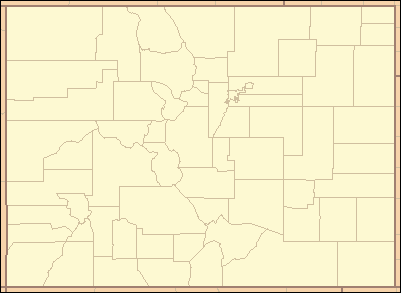
| DescriptionColorado Locator Map.PNG | Locator Map of Colorado, United States |
| Date | |
| Source | taken from US Census website [1] and modified by User:Ruhrfisch |
| Author | US Census, Ruhrfisch |
| Permission (Reusing this file) |
US Census / US Government work is public domain, my modifications licensed under the GNU Free Documentation License |
Licensing
I, Ruhrfisch, the copyright holder of this work, hereby publishes it under the following licenses:

|
Permission is granted to copy, distribute and/or modify this document under the terms of the GNU Free Documentation License, Version 1.2 or any later version published by the Free Software Foundation; with no Invariant Sections, no Front-Cover Texts, and no Back-Cover Texts. A copy of the license is included in the section entitled GNU Free Documentation License.http://www.gnu.org/copyleft/fdl.htmlGFDLGNU Free Documentation Licensetruetrue |
| This file is licensed under the Creative Commons Attribution-Share Alike 3.0 Unported license. | ||
| Attribution: I, Ruhrfisch | ||
| ||
| This licensing tag was added to this file as part of the GFDL licensing update.http://creativecommons.org/licenses/by-sa/3.0/CC BY-SA 3.0Creative Commons Attribution-Share Alike 3.0truetrue |
This file is licensed under the Creative Commons Attribution-Share Alike 2.5 Generic license.
Attribution: I, Ruhrfisch
- You are free:
- to share – to copy, distribute and transmit the work
- to remix – to adapt the work
- Under the following conditions:
- attribution – You must give appropriate credit, provide a link to the license, and indicate if changes were made. You may do so in any reasonable manner, but not in any way that suggests the licensor endorses you or your use.
- share alike – If you remix, transform, or build upon the material, you must distribute your contributions under the same or compatible license as the original.
You may select the license of your choice.
and
| Public domainPublic domainfalsefalse |
This image or file is a work of a United States Census Bureau employee, taken or made as part of that person's official duties. As a work of the U.S. federal government, the image is in the public domain.
English ∙ español ∙ 日本語 ∙ македонски ∙ മലയാളം ∙ português do Brasil ∙ русский ∙ українська ∙ עברית ∙ +/− |
 |
Captions
Add a one-line explanation of what this file represents
Items portrayed in this file
depicts
July 2007
image/png
cb3e8647df36968a55800089b7c84981e94d4ca4
8,893 byte
293 pixel
401 pixel
File history
Click on a date/time to view the file as it appeared at that time.
| Date/Time | Thumbnail | Dimensions | User | Comment | |
|---|---|---|---|---|---|
| current | 21:33, 30 July 2007 | | 401 × 293 (9 KB) | Ruhrfisch | fix state color, all other info the same |
| 21:17, 30 July 2007 |  | 401 × 293 (9 KB) | Ruhrfisch | {{Information| |Description= Locator Map of Colorado, United States |Source= taken from US Census website [http://factfinder.census.gov/] and modified by User:Ruhrfisch |Date= July 2007 |Author= US Census, Ruhrfisch |Permission= US Census / US Govern |
File usage
The following pages on the English Wikipedia use this file (pages on other projects are not listed):
- List of Colorado counties by population
- List of Colorado counties by socioeconomic factors
- List of Colorado county high points
- List of National Historic Landmarks in Colorado
- List of counties in Colorado
- List of county seats in Colorado
- List of museums in Colorado
- List of populated places in Colorado: A–F
- List of populated places in Colorado: G–O
- List of populated places in Colorado: P–Z
- List of populated places in Colorado by county: A–E
- List of populated places in Colorado by county: F–L
- List of populated places in Colorado by county: M–Z
- List of post offices in Colorado
- List of prehistoric sites in Colorado
- List of school districts in Colorado
- Population history of Colorado census-designated places
- User:Blåmerke
- Wikipedia:WikiProject Colorado/CDPs
- Wikipedia:WikiProject Colorado/Counties
- Wikipedia:WikiProject Colorado/GNIS places needing verification
- Wikipedia:WikiProject Colorado/Municipalities
- Template:Colorado County Labelled Map
- Template:List of populated places in Colorado by county header
- Template:List of populated places in Colorado header
- Template:List of post offices in Colorado header
- Template:WikiProject Colorado/sandbox
- Draft:List of places in Colorado: A–F
- Draft:List of places in Colorado: G–O
- Draft:List of places in Colorado: P–Z
- Draft:List of places in Colorado header
Global file usage
The following other wikis use this file:
- Usage on de.wikipedia.org
- Usage on es.wikipedia.org
- Usage on fa.wikipedia.org
- Usage on hu.wikipedia.org
- Usage on hu.wiktionary.org
- Usage on mr.wikipedia.org
- एल पासो काउंटी, कॉलोराडो
- कॉलोराडोमधील काउंटी
- साचा:कॉलोराडो काउंटी नकाशा
- डग्लस काउंटी, कॉलोराडो
- ॲडम्स काउंटी, कॉलोराडो
- अरापाहो काउंटी, कॉलोराडो
- अलामोसा काउंटी, कॉलोराडो
- आर्चुलेटा काउंटी, कॉलोराडो
- बोल्डर काउंटी, कॉलोराडो
- जेफरसन काउंटी, कॉलोराडो
- टेलर काउंटी, कॉलोराडो
- पेब्लो काउंटी, कॉलोराडो
- फ्रीमाँट काउंटी, कॉलोराडो
- बाका काउंटी, कॉलोराडो
- बेंट काउंटी, कॉलोराडो
- डोलोरेस काउंटी, कॉलोराडो
- शेफी काउंटी, कॉलोराडो
- क्लियर क्रीक काउंटी, कॉलोराडो
- शायान काउंटी, कॉलोराडो
- कोनेहोस काउंटी, कॉलोराडो
- कॉस्टिया काउंटी, कॉलोराडो
- क्राउली काउंटी, कॉलोराडो
- कस्टर काउंटी, कॉलोराडो
- डेल्टा काउंटी, कॉलोराडो
- ईगल काउंटी, कॉलोराडो
- एल्बर्ट काउंटी, कॉलोराडो
- गारफील्ड काउंटी, कॉलोराडो
- हुएर्फानो काउंटी, कॉलोराडो
- लेक काउंटी, कॉलोराडो
- लारीमर काउंटी, कॉलोराडो
- लास ॲनिमास काउंटी, कॉलोराडो
- लोगन काउंटी, कॉलोराडो
- मेसा काउंटी, कॉलोराडो
- मॉर्गन काउंटी, कॉलोराडो
- पार्क काउंटी, कॉलोराडो
- सेजविक काउंटी, कॉलोराडो
- वेल्ड काउंटी, कॉलोराडो
- ला प्लाटा काउंटी, कॉलोराडो
- लिंकन काउंटी, कॉलोराडो
View more global usage of this file.
Retrieved from "https://en.wikipedia.org/wiki/File:Colorado_Locator_Map.PNG"