File:CoosBayMap.jpg
From Wikipedia, the free encyclopedia
Size of this preview: 480 × 600 pixels. Other resolutions: 192 × 240 pixels | 384 × 480 pixels | 614 × 768 pixels | 1,060 × 1,325 pixels.
Original file (1,060 × 1,325 pixels, file size: 236 KB, MIME type: image/jpeg)
| This is a file from the Wikimedia Commons. Information from its description page there is shown below. Commons is a freely licensed media file repository. You can help. |
Summary
| DescriptionCoosBayMap.jpg |
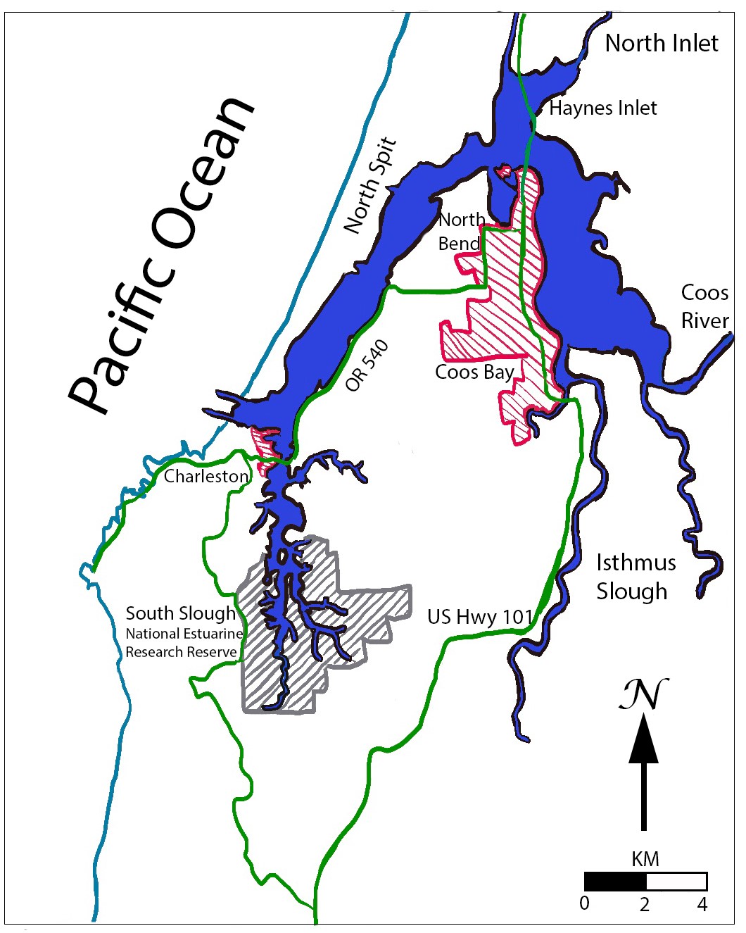
English: A hand-drawn map of Coos Bay / South Slough estuaries, Oregon with key locations labeled. This map is based on figure 1.20 from Rumrill, (2008). "The Ecology of the South Slough Estuary: Site Profile of the South Slough National Estuarine Research Reserve." |
| Date | |
| Source | Own work |
| Author | AngstyArmadillo |
Licensing
I, the copyright holder of this work, hereby publish it under the following license:
This file is licensed under the Creative Commons Attribution-Share Alike 4.0 International license.
- You are free:
- to share – to copy, distribute and transmit the work
- to remix – to adapt the work
- Under the following conditions:
- attribution – You must give appropriate credit, provide a link to the license, and indicate if changes were made. You may do so in any reasonable manner, but not in any way that suggests the licensor endorses you or your use.
- share alike – If you remix, transform, or build upon the material, you must distribute your contributions under the same or compatible license as the original.
Captions
A hand-drawn map of Coos Bay / South Slough estuaries, Oregon, with key locations labeled. Based on a figure by Steve Rumrill, 2008.
Items portrayed in this file
depicts
some value
1 December 2022
image/jpeg
6d5a157d79d316ed181cf5974fcdacc88a65226e
242,010 byte
1,325 pixel
1,060 pixel
File history
Click on a date/time to view the file as it appeared at that time.
| Date/Time | Thumbnail | Dimensions | User | Comment | |
|---|---|---|---|---|---|
| current | 23:01, 1 December 2022 | | 1,060 × 1,325 (236 KB) | AngstyArmadillo | Uploaded own work with UploadWizard |
File usage
The following pages on the English Wikipedia use this file (pages on other projects are not listed):
Retrieved from "https://en.wikipedia.org/wiki/File:CoosBayMap.jpg"