File:Delaware_Locator_Map.PNG
From Wikipedia, the free encyclopedia
No higher resolution available.
Delaware_Locator_Map.PNG (377 × 339 pixels, file size: 12 KB, MIME type: image/png)
| This is a file from the Wikimedia Commons. Information from its description page there is shown below. Commons is a freely licensed media file repository. You can help. |
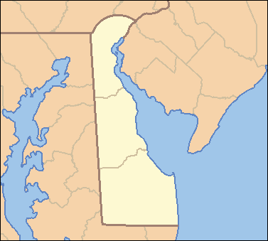
| DescriptionDelaware Locator Map.PNG | Locator Map of Delaware, United States |
| Date | |
| Source | taken from US Census website [1] and modified by User:VerruckteDan |
| Author | US Census, VerruckteDan |
| Permission (Reusing this file) |
US Census / US Government work is public domain, my modifications licensed under the GNU Free Documentation License |
| Other versions | one without black border, different water color |

|
Permission is granted to copy, distribute and/or modify this document under the terms of the GNU Free Documentation License, Version 1.2 or any later version published by the Free Software Foundation; with no Invariant Sections, no Front-Cover Texts, and no Back-Cover Texts. A copy of the license is included in the section entitled GNU Free Documentation License.http://www.gnu.org/copyleft/fdl.htmlGFDLGNU Free Documentation Licensetruetrue |
| This file is licensed under the Creative Commons Attribution-Share Alike 3.0 Unported license. | ||
| ||
| This licensing tag was added to this file as part of the GFDL licensing update.http://creativecommons.org/licenses/by-sa/3.0/CC BY-SA 3.0Creative Commons Attribution-Share Alike 3.0truetrue |
Captions
Add a one-line explanation of what this file represents
Items portrayed in this file
depicts
April 2007
File history
Click on a date/time to view the file as it appeared at that time.
| Date/Time | Thumbnail | Dimensions | User | Comment | |
|---|---|---|---|---|---|
| current | 03:54, 25 April 2007 | | 377 × 339 (12 KB) | Ruhrfisch | {{Information| |Description= Locator Map of Delaware, United States |Source= taken from US Census website [http://factfinder.census.gov/] and modified by User:VerruckteDan |Date= April 2007 |Author= US Census, VerruckteDan |Permission= US Census / US |
| 14:23, 24 April 2007 |  | 377 × 339 (12 KB) | Ruhrfisch | {{Information| |Description= Locator Map of Delaware, United States |Source= taken from US Census website [http://factfinder.census.gov/] and modified by User:VerruckteDan |Date= April 2007 |Author= US Census, VerruckteDan |Permission= US Census / US | |
| 01:33, 23 April 2007 |  | 377 × 339 (12 KB) | Ruhrfisch | {{Information| |Description= Locator Map of Delaware, United States |Source= taken from US Census website [http://factfinder.census.gov/] and modified by User:VerruckteDan |Date= April 2007 |Author= US Census, VerruckteDan |Permission= US Census / US | |
| 22:04, 22 April 2007 |  | 377 × 339 (12 KB) | VerruckteDan |
File usage
The following pages on the English Wikipedia use this file (pages on other projects are not listed):
Global file usage
The following other wikis use this file:
- Usage on de.wikipedia.org
- Usage on fa.wikipedia.org
- Usage on hu.wiktionary.org
- Usage on id.wikipedia.org
- Usage on ja.wikipedia.org
- Usage on new.wikipedia.org
- Usage on no.wikipedia.org
- Usage on pam.wikipedia.org
- Usage on si.wikipedia.org
- Usage on sr.wikipedia.org
- Довер (Делавер)
- Вилмингтон (Делавер)
- Белфонт (Делавер)
- Клејтон (Делавер)
- Делавер Сити
- Елсмир (Делавер)
- Харингтон (Делавер)
- Луис (Делавер)
- Мидлтаун (Делавер)
- Милфорд (Делавер)
- Њу Касл (Делавер)
- Рехобот Бич (Делавер)
- Сифорд (Делавер)
- Смирна (Делавер)
- Таунсенд (Делавер)
- Довер Бејс Хаусинг (Делавер)
- Пајк Крик Вали (Делавер)
- Шаблон:Location map Delaware
- Usage on uz.wikipedia.org
- Usage on vi.wikipedia.org
- Usage on zh.wikipedia.org
Metadata
This file contains additional information, probably added from the digital camera or scanner used to create or digitize it.
If the file has been modified from its original state, some details may not fully reflect the modified file.
| Software used |
|---|
Retrieved from "https://en.wikipedia.org/wiki/File:Delaware_Locator_Map.PNG"