File:EEZ_France.png
From Wikipedia, the free encyclopedia
Size of this preview: 800 × 391 pixels. Other resolutions: 320 × 156 pixels | 640 × 313 pixels | 1,024 × 501 pixels | 1,280 × 626 pixels | 2,410 × 1,178 pixels.
Original file (2,410 × 1,178 pixels, file size: 317 KB, MIME type: image/png)
| This is a file from the Wikimedia Commons. Information from its description page there is shown below. Commons is a freely licensed media file repository. You can help. |
Summary

|
File:Territorial waters - France.svg is a vector version of this file. It should be used in place of this PNG file.
File:EEZ France.png → File:Territorial waters - France.svg
For more information, see Help:SVG.
|
 |
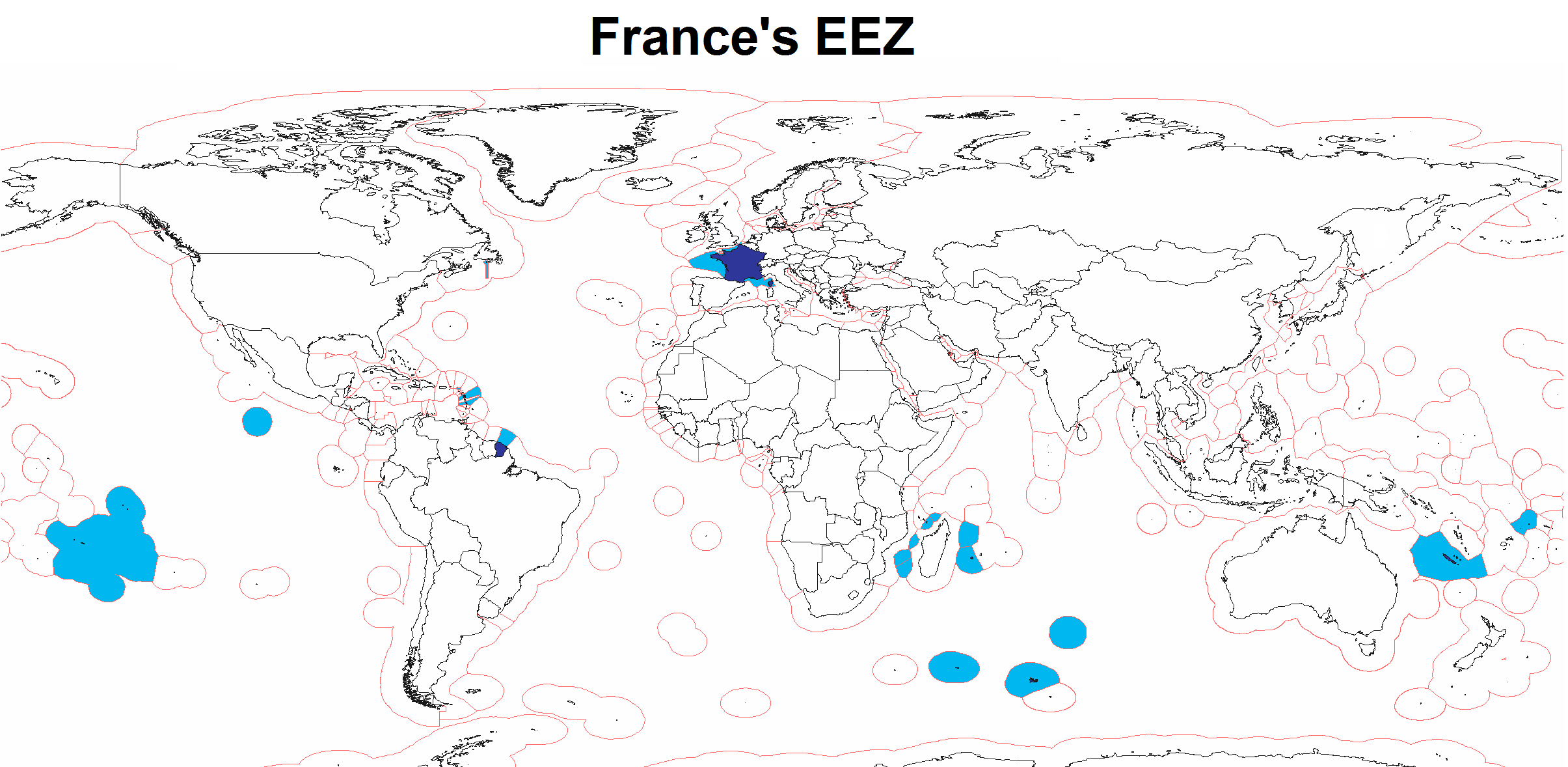
| DescriptionEEZ France.png | Map of France's Exclusive Economic Zone |
| Date | |
| Source | Own work |
| Author | Godefroy |
| Other versions | Derivative works of this file: WorldEEZ.png |
Licensing
I, the copyright holder of this work, hereby publish it under the following licenses:

|
Permission is granted to copy, distribute and/or modify this document under the terms of the GNU Free Documentation License, Version 1.2 or any later version published by the Free Software Foundation; with no Invariant Sections, no Front-Cover Texts, and no Back-Cover Texts. A copy of the license is included in the section entitled GNU Free Documentation License.http://www.gnu.org/copyleft/fdl.htmlGFDLGNU Free Documentation Licensetruetrue |
| This file is licensed under the Creative Commons Attribution-Share Alike 3.0 Unported license. | ||
| ||
| This licensing tag was added to this file as part of the GFDL licensing update.http://creativecommons.org/licenses/by-sa/3.0/CC BY-SA 3.0Creative Commons Attribution-Share Alike 3.0truetrue |
You may select the license of your choice.
Captions
Add a one-line explanation of what this file represents
Items portrayed in this file
depicts
17 March 2008
File history
Click on a date/time to view the file as it appeared at that time.
| Date/Time | Thumbnail | Dimensions | User | Comment | |
|---|---|---|---|---|---|
| current | 14:45, 25 July 2020 | | 2,410 × 1,178 (317 KB) | Maphobbyist | Added the borders of South Sudan and Montengro, and the Sea of Okhotsk is now wholly within the Russian EEZ. |
| 05:16, 3 February 2010 |  | 2,410 × 1,178 (289 KB) | Insider | little correction | |
| 15:33, 17 March 2008 |  | 2,410 × 1,178 (183 KB) | Godefroy~commonswiki | {{Information |Description=Map of France's EEZ |Source=self-made |Date=March 17, 2008 |Author= Godefroy |Permission= |other_versions= }} |
File usage
No pages on the English Wikipedia use this file (pages on other projects are not listed).
Global file usage
The following other wikis use this file:
- Usage on en.wikibooks.org
- Usage on fr.wikipedia.org
- Usage on fr.wikiversity.org
- Usage on hy.wikipedia.org
- Usage on id.wikipedia.org
- Usage on it.wikipedia.org
- Usage on kn.wikipedia.org
- Usage on mk.wikipedia.org
- Usage on nn.wikipedia.org
- Usage on ro.wikibooks.org
- Usage on te.wikipedia.org
- Usage on www.wikidata.org
Metadata
This file contains additional information, probably added from the digital camera or scanner used to create or digitize it.
If the file has been modified from its original state, some details may not fully reflect the modified file.
| Horizontal resolution | 37.8 dpc |
|---|---|
| Vertical resolution | 37.8 dpc |
| Software used |
Retrieved from "https://en.wikipedia.org/wiki/File:EEZ_France.png"