File:Frankfurt_am_Main_-_Netzplan_Schienennahverkehr_(einfach).png
From Wikipedia, the free encyclopedia
Size of this preview: 800 × 574 pixels. Other resolutions: 320 × 230 pixels | 640 × 459 pixels | 1,024 × 735 pixels | 1,280 × 918 pixels | 2,537 × 1,820 pixels.
Original file (2,537 × 1,820 pixels, file size: 1.26 MB, MIME type: image/png)
| This is a file from the Wikimedia Commons. Information from its description page there is shown below. Commons is a freely licensed media file repository. You can help. |
Summary
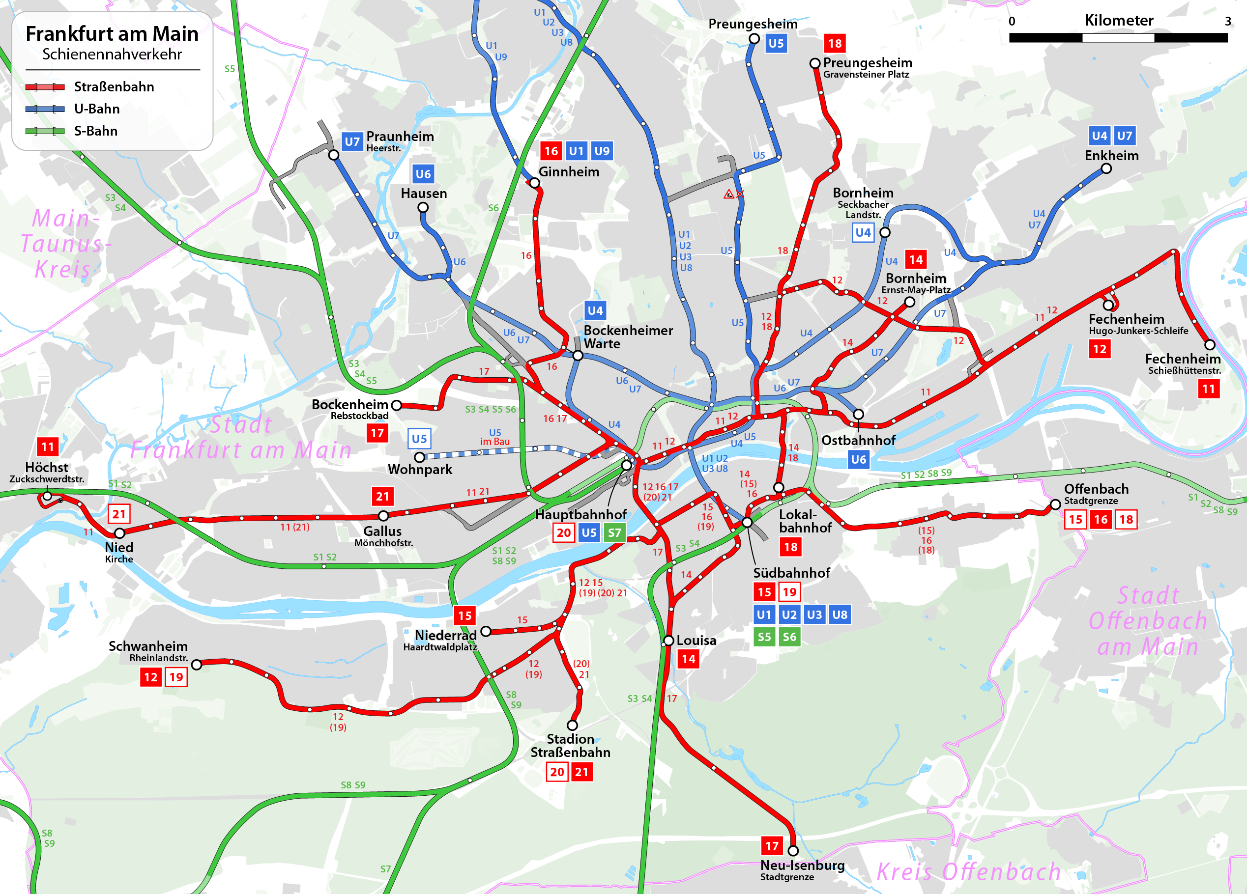
| DescriptionFrankfurt am Main - Netzplan Schienennahverkehr (einfach).png |
|
| Date | see file history |
| Source | Own work, using OpenStreetMap data for the background |
| Author | Maximilian Dörrbecker (Chumwa) |
| Permission (Reusing this file) |
All OpenStreetMap data and maps are Creative Commons "CC-BY-SA 2.0" licensed This file is licensed under the Creative Commons Attribution-Share Alike 2.0 Generic license.
|
| Other versions |
|

.png)


|
This transport map image could be re-created using vector graphics as an SVG file. This has several advantages; see Commons:Media for cleanup for more information. If an SVG form of this image is available, please upload it and afterwards replace this template with
{{vector version available|new image name}}.
It is recommended to name the SVG file “Frankfurt am Main - Netzplan Schienennahverkehr (einfach).svg”—then the template Vector version available (or Vva) does not need the new image name parameter. |
Captions
Add a one-line explanation of what this file represents
Items portrayed in this file
depicts
File history
Click on a date/time to view the file as it appeared at that time.
| Date/Time | Thumbnail | Dimensions | User | Comment | |
|---|---|---|---|---|---|
| current | 14:00, 5 January 2019 | | 2,537 × 1,820 (1.26 MB) | Chumwa | Streckentausch U6 ←→ U7 |
| 16:37, 5 October 2017 |  | 2,537 × 1,820 (1.26 MB) | Chumwa | Planungen wieder herausgenommen | |
| 17:39, 4 October 2017 |  | 2,537 × 1,820 (1.26 MB) | Chumwa | Aktualisierung | |
| 05:18, 17 December 2014 |  | 2,537 × 1,820 (1.25 MB) | Chumwa | corr | |
| 04:35, 15 December 2014 |  | 2,537 × 1,820 (1.25 MB) | Chumwa | Lieschen raus, Gallus Süd nur noch Betriebsstrecke | |
| 19:52, 14 December 2014 |  | 2,537 × 1,820 (1.26 MB) | Chumwa | Fahrplanwechsel 14.12.2014 | |
| 19:58, 25 December 2011 |  | 2,537 × 1,820 (1.21 MB) | Chumwa | {{Information |Description= *{{ de }} Netzplan der Straßenbahn Frankfurt am Main *{{ en }} Map of the Frankfurt tramway system *{{ fr }} Plan de réseau du tramway de Francfort-sur-le-Main |Author=Maximilian Dörrbecker ([[:de:User:Ch |
File usage
The following pages on the English Wikipedia use this file (pages on other projects are not listed):
Global file usage
The following other wikis use this file:
- Usage on bar.wikipedia.org
- Usage on de.wikipedia.org
- Straßenbahn Frankfurt am Main
- Vorlage:Infobox Straßenbahnsystem
- Vorlage:Infobox Straßenbahnsystem/Doku
- Wikipedia:Kartenwerkstatt/Archiv/2012-01
- Wikipedia:Kartenwerkstatt/Archiv/2014-12
- Wikipedia:Auskunft/Archiv/2015/Woche 51
- Wikipedia:Kartenwerkstatt/Archiv/2017-10
- Benutzer Diskussion:Chumwa/Archiv/2021/1. Quartal
- Usage on eo.wikipedia.org
- Usage on fa.wikipedia.org
- Usage on ko.wikipedia.org
- Usage on pl.wikipedia.org
- Usage on sv.wikipedia.org
Metadata
This file contains additional information, probably added from the digital camera or scanner used to create or digitize it.
If the file has been modified from its original state, some details may not fully reflect the modified file.
| Horizontal resolution | 59.06 dpc |
|---|---|
| Vertical resolution | 59.06 dpc |
| Software used |