File:Great_Blizzard_1978-01-26_weather_map.png
From Wikipedia, the free encyclopedia
Size of this preview: 800 × 556 pixels. Other resolutions: 320 × 222 pixels | 640 × 444 pixels | 1,024 × 711 pixels | 1,316 × 914 pixels.
Original file (1,316 × 914 pixels, file size: 314 KB, MIME type: image/png)
| This is a file from the Wikimedia Commons. Information from its description page there is shown below. Commons is a freely licensed media file repository. You can help. |
Summary
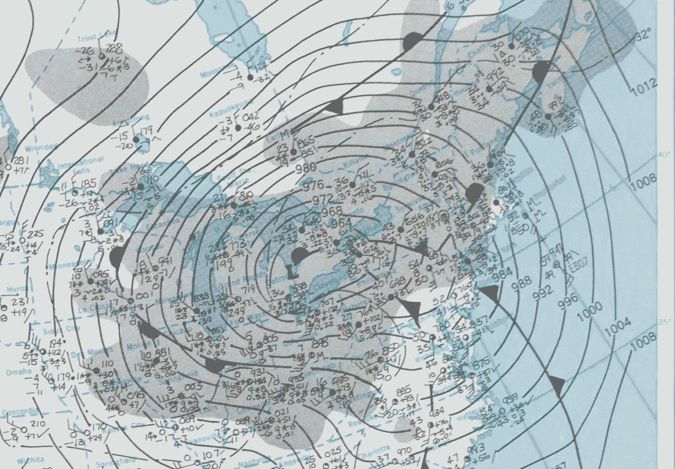
| DescriptionGreat Blizzard 1978-01-26 weather map.png | |||||
| Date | |||||
| Source | NOAA Central Library Data Imaging Project | ||||
| Author | NOAA Central Library, Silver Spring, Maryland | ||||
| Permission (Reusing this file) |
|
File history
Click on a date/time to view the file as it appeared at that time.
| Date/Time | Thumbnail | Dimensions | User | Comment | |
|---|---|---|---|---|---|
| current | 19:51, 19 January 2007 | | 1,316 × 914 (314 KB) | Dual Freq | {{Information |Description=January 17, 1982 Surface map |Source=Cropped from January 26, 1978 page of [http://docs.lib.noaa.gov/rescue/dwm/1978/19780123-19780129.djvu January 23 - January 29, 1978 weekly weather map] from [http://docs.lib.noaa.gov/rescue/ |
File usage
The following pages on the English Wikipedia use this file (pages on other projects are not listed):
Global file usage
The following other wikis use this file:
- Usage on fr.wikipedia.org
- Usage on is.wikipedia.org
- Usage on ja.wikipedia.org
- Usage on nds.wikipedia.org
Metadata
This file contains additional information, probably added from the digital camera or scanner used to create or digitize it.
If the file has been modified from its original state, some details may not fully reflect the modified file.
| File change date and time | 19:43, 19 January 2007 |
|---|---|
| Horizontal resolution | 28.34 dpc |
| Vertical resolution | 28.34 dpc |