File:Huka_Falls.jpg
From Wikipedia, the free encyclopedia
Original file (2,272 × 1,704 pixels, file size: 1.16 MB, MIME type: image/jpeg)
| This is a file from the Wikimedia Commons. Information from its description page there is shown below. Commons is a freely licensed media file repository. You can help. |
Summary
| DescriptionHuka Falls.jpg |
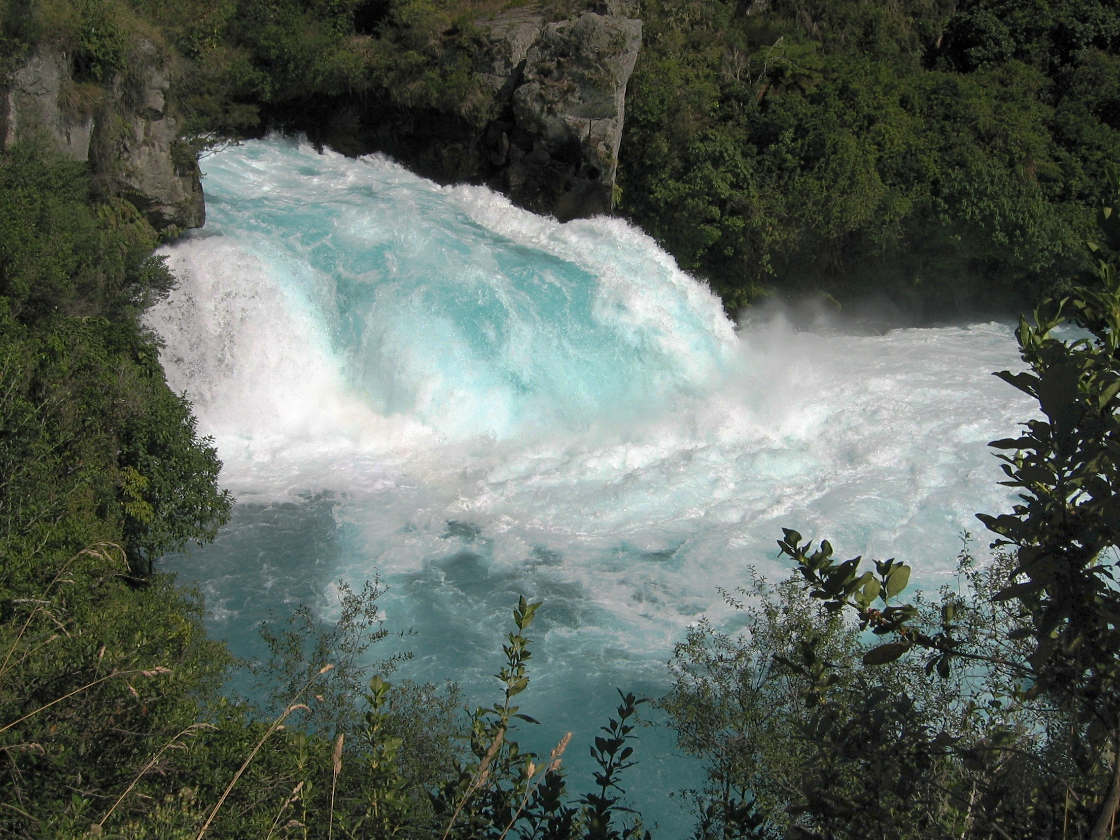
English: Huka Falls, on the Waikato River near Taupo, New Zealand. |
| Date | |
| Source | Own work |
| Author | Avenue |
| Other versions |
|
| Camera location | 38° 38′ 53.3″ S, 176° 05′ 27.96″ E | View this and other nearby images on: OpenStreetMap |
|---|
| This is a retouched picture, which means that it has been digitally altered from its original version. Modifications: Curves adjusted for more contrast; sharpened slightly.
|
This image has been assessed using the Quality image guidelines and is considered a Quality image.
العربية ∙ جازايرية ∙ беларуская ∙ беларуская (тарашкевіца) ∙ български ∙ বাংলা ∙ català ∙ čeština ∙ Cymraeg ∙ Deutsch ∙ Schweizer Hochdeutsch ∙ Zazaki ∙ Ελληνικά ∙ English ∙ Esperanto ∙ español ∙ eesti ∙ euskara ∙ فارسی ∙ suomi ∙ français ∙ galego ∙ עברית ∙ हिन्दी ∙ hrvatski ∙ magyar ∙ հայերեն ∙ Bahasa Indonesia ∙ italiano ∙ 日本語 ∙ Jawa ∙ ქართული ∙ 한국어 ∙ kurdî ∙ Lëtzebuergesch ∙ lietuvių ∙ македонски ∙ മലയാളം ∙ मराठी ∙ Bahasa Melayu ∙ Nederlands ∙ Norfuk / Pitkern ∙ polski ∙ português ∙ português do Brasil ∙ rumantsch ∙ română ∙ русский ∙ sicilianu ∙ slovenčina ∙ slovenščina ∙ shqip ∙ српски / srpski ∙ svenska ∙ தமிழ் ∙ తెలుగు ∙ ไทย ∙ Tagalog ∙ Türkçe ∙ toki pona ∙ українська ∙ vèneto ∙ Tiếng Việt ∙ 中文 ∙ 中文(简体) ∙ 中文(繁體) ∙ +/− |
Licensing
- You are free:
- to share – to copy, distribute and transmit the work
- to remix – to adapt the work
- Under the following conditions:
- attribution – You must give appropriate credit, provide a link to the license, and indicate if changes were made. You may do so in any reasonable manner, but not in any way that suggests the licensor endorses you or your use.
- share alike – If you remix, transform, or build upon the material, you must distribute your contributions under the same or compatible license as the original.

|
Permission is granted to copy, distribute and/or modify this document under the terms of the GNU Free Documentation License, Version 1.2 or any later version published by the Free Software Foundation; with no Invariant Sections, no Front-Cover Texts, and no Back-Cover Texts. A copy of the license is included in the section entitled GNU Free Documentation License.http://www.gnu.org/copyleft/fdl.htmlGFDLGNU Free Documentation Licensetruetrue |
Captions
Items portrayed in this file
depicts
15 March 2006
38°38'53.30"S, 176°5'27.96"E
0.001 second
7.1
8.625 millimetre
image/jpeg
File history
Click on a date/time to view the file as it appeared at that time.
| Date/Time | Thumbnail | Dimensions | User | Comment | |
|---|---|---|---|---|---|
| current | 02:11, 12 December 2010 | | 2,272 × 1,704 (1.16 MB) | Avenue | Curves adjusted for more contrast; sharpened slightly. |
| 04:09, 29 March 2010 |  | 2,272 × 1,704 (1.11 MB) | Avenue | Increase brightness slightly | |
| 16:14, 28 March 2010 |  | 2,272 × 1,704 (1.19 MB) | Avenue | {{Information |Description={{en|1=Huka Falls, on the Waikato River near Taupo, New Zealand.}} |Source={{own}} |Author=Avenue |Date=2006-03-15 |Permission= |other_versions= }} Category:Waikato River Category:Taupo [[Category:Waterfa |
File usage
More than 100 pages use this file. The following list shows the first 100 pages that use this file only. A full list is available.
- Aberdeen Falls
- Adyanpara Falls
- Agaya Gangai
- Aldeyjarfoss
- Amicalola Falls
- Ammons Creek Falls
- Baker's Falls
- Barr Creek Falls
- Berkelah Falls
- Bilbrough Falls
- Black Banksia Falls
- Bloomfield Falls
- Bogomila Falls
- Boundary Falls
- Browne Falls
- Burgess Falls
- Carrington Falls
- Catherine Falls
- Chiling Waterfalls
- Clamshell Falls
- Cola de Caballo
- Crystal Cascades
- Davies Creek Falls
- DeSoto Falls (Alabama)
- Delaneys Falls
- Dip Falls
- Dolgoch Falls
- Duduma Waterfalls
- Edith Falls
- Espeland Falls
- Fall Creek Falls
- Faxi
- Florence Falls
- Fulmer Falls
- Gjáin
- Guide Falls
- Gunlom Falls
- Hemlock Falls
- Herbert River Falls
- Holcomb Creek Falls
- Hopetoun Falls
- Horseshoe Falls (Tasmania)
- Huka Falls
- Humboldt Falls
- Háifoss
- Issaqueena Falls
- Janet's Foss
- Josephine Falls
- Kanangra Falls
- Kanching Falls
- Kearneys Falls
- Kjelfossen
- Kota Tinggi Waterfalls
- Kumbakkarai Falls
- Leichhardt Falls
- Liffey Falls
- Malanda Falls
- Mandraka Falls
- Meenmutty Falls (Thiruvananthapuram)
- Meenmutty Falls (Wayanad)
- Mill Creek Falls
- Millstream Falls
- Milmilgee Falls
- Mongefossen
- Mount Damper Falls
- Murray Falls
- Nohkalikai Falls
- Piedra Volada
- Purling Brook Falls
- Quarry Falls (Macon County)
- Queen Mary Falls
- Ramnefjellsfossen
- Rathna Ella
- Rjukan Falls
- Russell Falls
- Rusumo Falls
- Selfoss (waterfall)
- Sengupathi Falls
- Shalmash Falls
- Silver Strand Falls
- Soochipara Falls
- Spout of Garnock
- Stoney Creek Falls
- Superior Falls
- Surprise Creek Falls
- Sutherland Falls
- Svartifoss
- Tchupala Falls
- Te Rere o Kapuni
- Tinaroo Falls
- Tjaynera Falls
- Tolmer Falls
- Tully Falls
- Twin Falls (Northern Territory)
- Vaideki Falls
- Valentine Falls
- Vazhachal Falls
- Wangi Falls
- Whangārei Falls
- Whites Falls
View more links to this file.
Global file usage
The following other wikis use this file:
- Usage on arz.wikipedia.org
- Usage on br.wikipedia.org
- Usage on ca.wikipedia.org
- Usage on de.wikivoyage.org
- Usage on en.wikivoyage.org
- Usage on fa.wikipedia.org
- Usage on fr.wikipedia.org
- Usage on hu.wikipedia.org
- Usage on id.wikipedia.org
- Usage on ko.wikipedia.org
- Usage on ml.wikipedia.org
- Usage on mzn.wikipedia.org
- Usage on pnb.wikipedia.org
- Usage on ru.wikipedia.org
- Usage on sat.wikipedia.org
- Usage on tg.wikipedia.org
- Usage on uk.wikipedia.org
- Usage on ur.wikipedia.org
- Usage on www.wikidata.org
Metadata
This file contains additional information, probably added from the digital camera or scanner used to create or digitize it.
If the file has been modified from its original state, some details may not fully reflect the modified file.
| Camera manufacturer | Canon |
|---|---|
| Camera model | Canon PowerShot S45 |
| Exposure time | 1/1,000 sec (0.001) |
| F-number | f/7.1 |
| Date and time of data generation | 11:53, 15 March 2006 |
| Lens focal length | 8.625 mm |
| Orientation | Normal |
| Horizontal resolution | 72 dpi |
| Vertical resolution | 72 dpi |
| File change date and time | 15:06, 12 December 2010 |
| Y and C positioning | Centered |
| Exif version | 2.2 |
| Date and time of digitizing | 11:53, 15 March 2006 |
| Image compression mode | 3 |
| Shutter speed | 9.96875 |
| APEX aperture | 5.65625 |
| Exposure bias | 0 |
| Maximum land aperture | 3.34375 APEX (f/3.19) |
| Metering mode | Pattern |
| Flash | Flash did not fire, auto mode |
| Color space | sRGB |
| Focal plane X resolution | 8,114.2857142857 |
| Focal plane Y resolution | 8,114.2857142857 |
| Focal plane resolution unit | inches |
| Sensing method | One-chip color area sensor |
| Custom image processing | Normal process |
| Exposure mode | Auto exposure |
| White balance | Auto white balance |
| Digital zoom ratio | 1 |
| Scene capture type | Standard |