File:Limestone_hills_of_Tambun_near_the_Tibetan_Temple.jpg
From Wikipedia, the free encyclopedia
Size of this preview: 799 × 285 pixels. Other resolutions: 320 × 114 pixels | 640 × 228 pixels | 1,024 × 365 pixels | 1,280 × 457 pixels | 2,560 × 913 pixels | 7,096 × 2,532 pixels.
Original file (7,096 × 2,532 pixels, file size: 3.62 MB, MIME type: image/jpeg)
| This is a file from the Wikimedia Commons. Information from its description page there is shown below. Commons is a freely licensed media file repository. You can help. |
Summary
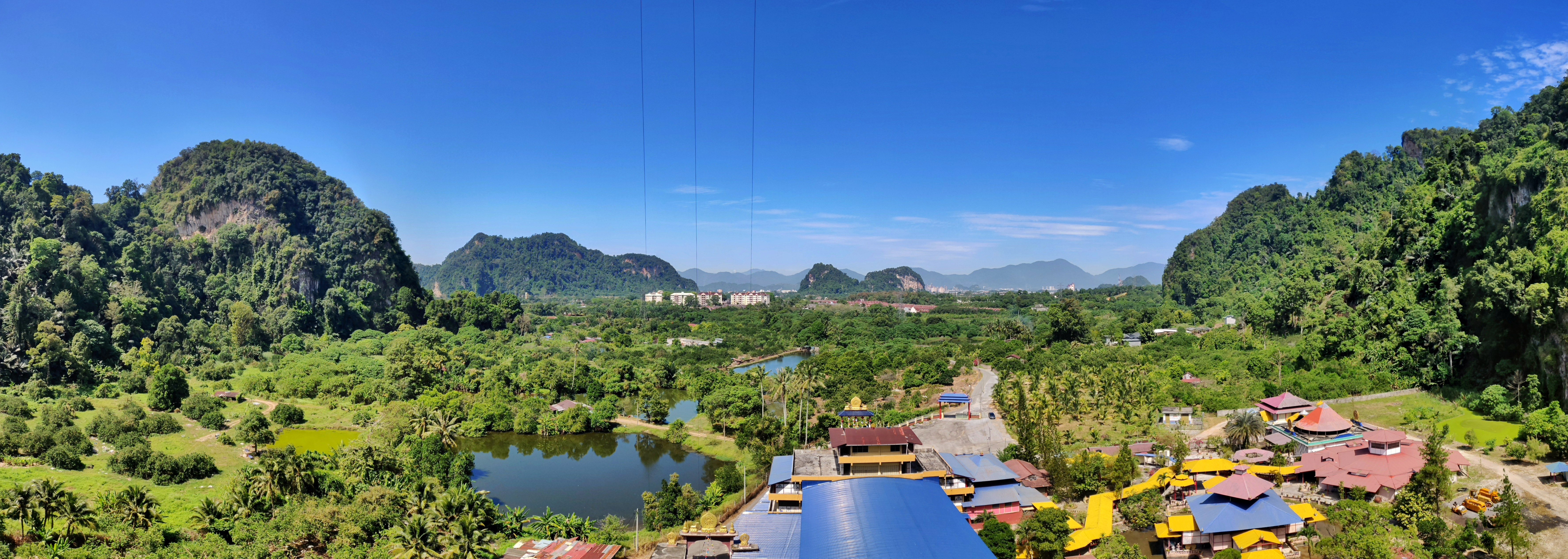
| DescriptionLimestone hills of Tambun near the Tibetan Temple.jpg |
English: Tibetan Temple in Tambun of Ipoh, Perak, Malaysia. |
|||||
| Date | ||||||
| Source | Tibetan Temple, Tambun, Malaysia | |||||
| Author | Dennis Sylvester Hurd | |||||
| Permission (Reusing this file) |
|
| Camera location | 4° 36′ 09.52″ N, 101° 09′ 18.56″ E | View this and other nearby images on: OpenStreetMap |
|---|
Captions
Add a one-line explanation of what this file represents
Items portrayed in this file
depicts
some value
12 February 2019
4°36'9.518"N, 101°9'18.562"E
image/jpeg
File history
Click on a date/time to view the file as it appeared at that time.
| Date/Time | Thumbnail | Dimensions | User | Comment | |
|---|---|---|---|---|---|
| current | 02:08, 19 October 2019 | 7,096 × 2,532 (3.62 MB) | Molecule Extraction | {{Information |description ={{en|1=Tibetan Temple in Tambun of Ipoh, Perak, Malaysia.}} |date =2019-02-12 |source =[https://www.flickr.com/photos/dennissylvesterhurd/46345923404/ Tibetan Temple, Tambun, Malaysia] |author =[https://www.flickr.com/people/dennissylvesterhurd/ Dennis Sylvester Hurd] |permission ={{cc-by-1.0}}{{Flickrreview}} }} Category:Ipoh |
File usage
The following pages on the English Wikipedia use this file (pages on other projects are not listed):
Global file usage
The following other wikis use this file:
Metadata
This file contains additional information, probably added from the digital camera or scanner used to create or digitize it.
If the file has been modified from its original state, some details may not fully reflect the modified file.
| Camera manufacturer | OnePlus |
|---|---|
| Camera model | ONEPLUS A6003 |
| Date and time of data generation | 11:46, 12 February 2019 |
| Latitude | 4° 36′ 9.52″ N |
| Longitude | 101° 9′ 18.56″ E |
| Altitude | 19.27 meters above sea level |
| Orientation | Normal |
| Software used | Snapseed 2.0 |
| File change date and time | 16:42, 12 February 2019 |
| Date and time of digitizing | 11:46, 12 February 2019 |
| Light source | Unknown |
| GPS time (atomic clock) | 03:45 |
| GPS date | 12 February 2019 |