File:Malaysia_relief_location_map.jpg
From Wikipedia, the free encyclopedia
Size of this preview: 800 × 305 pixels. Other resolutions: 320 × 122 pixels | 1,200 × 457 pixels.
Original file (1,200 × 457 pixels, file size: 396 KB, MIME type: image/jpeg)
| This is a file from the Wikimedia Commons. Information from its description page there is shown below. Commons is a freely licensed media file repository. You can help. |
Summary
| DescriptionMalaysia relief location map.jpg |
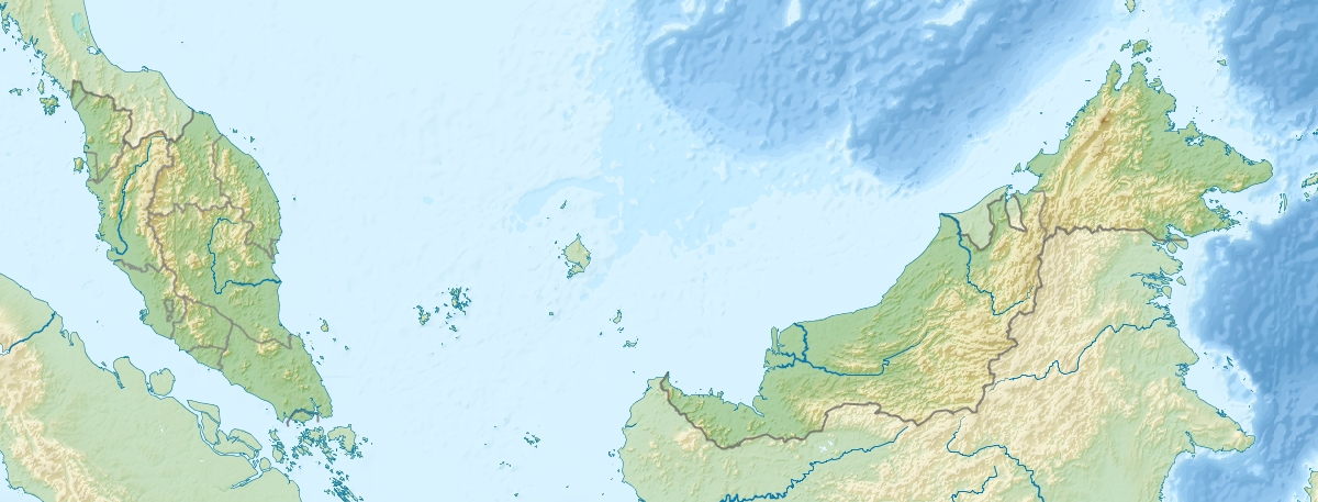
English: Location map of Malaysia.
Equirectangular projection. Strechted by 100.0%. Geographic limits of the map: * N: 8.0° N * S: 0.0° N * W: 99.0° E * E: 120.0° EMade with Natural Earth. Free vector and raster map data @ naturalearthdata.com. |
|||
| Date | ||||
| Source | Own work | |||
| Author | Uwe Dedering | |||
| Other versions |
|

Licensing
I, the copyright holder of this work, hereby publish it under the following licenses:
This file is licensed under the Creative Commons Attribution-Share Alike 3.0 Unported license.
- You are free:
- to share – to copy, distribute and transmit the work
- to remix – to adapt the work
- Under the following conditions:
- attribution – You must give appropriate credit, provide a link to the license, and indicate if changes were made. You may do so in any reasonable manner, but not in any way that suggests the licensor endorses you or your use.
- share alike – If you remix, transform, or build upon the material, you must distribute your contributions under the same or compatible license as the original.

|
Permission is granted to copy, distribute and/or modify this document under the terms of the GNU Free Documentation License, Version 1.2 or any later version published by the Free Software Foundation; with no Invariant Sections, no Front-Cover Texts, and no Back-Cover Texts. A copy of the license is included in the section entitled GNU Free Documentation License.http://www.gnu.org/copyleft/fdl.htmlGFDLGNU Free Documentation Licensetruetrue |
You may select the license of your choice.
Captions
Add a one-line explanation of what this file represents
Items portrayed in this file
depicts
some value
24 April 2010
File history
Click on a date/time to view the file as it appeared at that time.
| Date/Time | Thumbnail | Dimensions | User | Comment | |
|---|---|---|---|---|---|
| current | 09:38, 24 April 2010 | 1,200 × 457 (396 KB) | Uwe Dedering | {{Information |Description={{en|1=Location map of Malaysia. Equirectangular projection. Strechted by 100.0%. Geographic limits of the map: * N: 8.0° N * S: 0.0° N * W: 99.0° E * E: 120.0° E Made with Natural Earth. Free vector and raster map dat |
File usage
More than 100 pages use this file. The following list shows the first 100 pages that use this file only. A full list is available.
- 1976 Sabah earthquake
- 1982 Bukit Merah radioactive pollution
- 2002 Eisenhower Trophy
- 2015 Sabah earthquake
- 2015–16 Kuantan bauxite disaster
- 2019 Kim Kim River toxic pollution
- Al-Khawarizmi Astronomy Complex
- An-Nur Jamek Mosque, Labuan
- Ansonia echinata
- Ansonia guibei
- Ansonia tiomanica
- Ansonia vidua
- Bagan Lalang
- Bakun Dam
- Baram Dam
- Batang Ai Dam
- Bera Lake
- Bukit Malawati
- CIMB Classic
- Chenderoh Lake
- Chini Lake
- Clarias batu
- Crocker Mountains
- EurAsia Cup
- Feihyla inexpectata
- Iskandar Johor Open
- Kalophrynus eok
- Kalophrynus yongi
- Kanching Falls
- Kenyir Lake
- Kinabalu Park
- Klang Gates Quartz Ridge
- Lenggong
- Leptobrachella kajangensis
- List of World Heritage Sites in Malaysia
- Malaysia
- Malaysian Open (golf)
- Maybank Championship
- Memali Incident
- Meristogenys macrophthalmus
- Mount Alab
- Mount Batu Brinchang
- Mount Belumut
- Mount Benum
- Mount Bintang
- Mount Bombalai
- Mount Chamah
- Mount Danum
- Mount Gayong
- Mount Irau
- Mount Jerai
- Mount Kinabalu
- Mount Korbu
- Mount Lambak
- Mount Lawit
- Mount Ledang
- Mount Lucia
- Mount Magdalena
- Mount Maria (Malaysia)
- Mount Mulu
- Mount Nuang
- Mount Rumput
- Mount Santubong
- Mount Tahan
- Mount Tambuyukon
- Mount Tok Wan
- Mount Trusmadi
- Mount Yong Belar
- Mount Yong Yap
- Mukah
- Murum Dam
- Niah National Park
- Oligodon booliati
- Oya River
- Pagon Hill
- Parit Sulong Massacre
- Pedu Lake
- Pelophryne linanitensis
- Pelophryne murudensis
- Penang Strait
- Pergau Dam
- Putrajaya Lake
- Rhacophorus borneensis
- Saratok
- Sarawak Championship
- Sarawak rabies outbreak
- Selangor Masters
- Setiu Wetlands
- Sime Darby Harvard Championship
- Sime Darby LPGA Malaysia
- Skull Hill, Malaysia
- Taman Negara
- Trusmadi Range
- Volvo Masters of Malaysia
- User:Ty654/List of earthquakes from 1920-1929 exceeding magnitude 6+
- User:Ty654/List of earthquakes from 1950-1954 exceeding magnitude 6+
- User:Ty654/List of earthquakes from 1975-1979 exceeding magnitude 6+
- User:Ty654/List of earthquakes from 2015-2019 exceeding magnitude 6+
- Portal:Malaysia
- Portal:Malaysia/Intro
View more links to this file.
Global file usage
The following other wikis use this file:
- Usage on ace.wikipedia.org
- Usage on ar.wikipedia.org
- Usage on ast.wikipedia.org
- Usage on az.wikipedia.org
- Cohor boğazı
- Şablon:Nişanlama siyahısı
- Şablon:Yer xəritəsi Malayziya
- Kinabalu Milli Parkı
- Şablon:Nişanlama siyahısı/doc
- Malay yarımadası
- Endau-Rompin Milli Parkı
- Kinabalu
- Piay burnu
- Liqitan adası
- Mabul adası
- Ligitan arxipelaqı
- Kapalay adası
- Ketam adası
- Banqi adası
- Klanq adası
- Sebatik adası
- Sipadan adası
- Lanqkavi adaları
- Pinanq adası
- Malayziya coğrafiyası
- Usage on ban.wikipedia.org
- Usage on ba.wikipedia.org
- Usage on bcl.wikipedia.org
- Usage on be.wikipedia.org
- Usage on bg.wikipedia.org
View more global usage of this file.
Retrieved from "https://en.wikipedia.org/wiki/File:Malaysia_relief_location_map.jpg"