File:Map_Saint-Malo.jpg
From Wikipedia, the free encyclopedia
Size of this preview: 800 × 559 pixels. Other resolutions: 320 × 224 pixels | 640 × 448 pixels | 1,024 × 716 pixels | 1,280 × 895 pixels | 1,656 × 1,158 pixels.
Original file (1,656 × 1,158 pixels, file size: 650 KB, MIME type: image/jpeg)
| This is a file from the Wikimedia Commons. Information from its description page there is shown below. Commons is a freely licensed media file repository. You can help. |
Summary
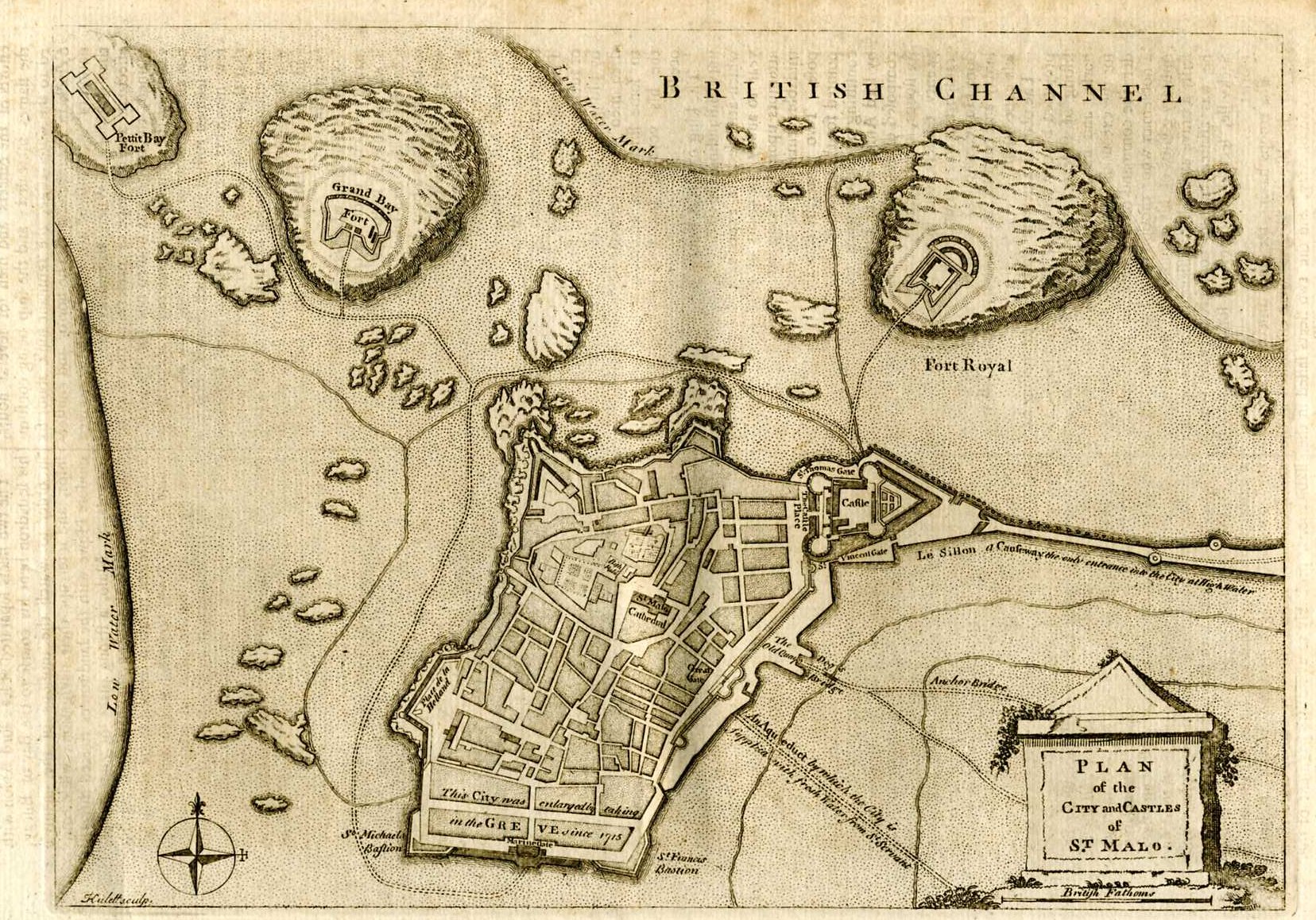
| DescriptionMap Saint-Malo.jpg |
Français : Carte anglaise de Saint Malo. English: English map of Saint Malo |
|||||
| Date |
after 1715 date QS:P,+1715-00-00T00:00:00Z/7,P1319,+1715-00-00T00:00:00Z/9 |
|||||
| Source | http://www.yourmapsonline.org.uk/rosmaps/mapchannelstmalo003.jpg | |||||
| Author | Unknown authorUnknown author | |||||
| Permission (Reusing this file) |
|
|||||
File history
Click on a date/time to view the file as it appeared at that time.
| Date/Time | Thumbnail | Dimensions | User | Comment | |
|---|---|---|---|---|---|
| current | 08:47, 23 August 2005 | | 1,656 × 1,158 (650 KB) | Donarreiskoffer | Map of Saint-Malo source:http://www.yourmapsonline.org.uk/rosmaps/mapchannelstmalo003.jpg {{PD}} |
File usage
The following pages on the English Wikipedia use this file (pages on other projects are not listed):
Global file usage
The following other wikis use this file:
- Usage on azb.wikipedia.org
- Usage on eo.wikipedia.org
- Usage on es.wikipedia.org
- Usage on fr.wikipedia.org
- Usage on hu.wikipedia.org
- Usage on hy.wikipedia.org
- Usage on ja.wikipedia.org
- Usage on la.wikipedia.org
- Usage on mk.wikipedia.org
- Usage on uk.wikipedia.org
Metadata
This file contains additional information, probably added from the digital camera or scanner used to create or digitize it.
If the file has been modified from its original state, some details may not fully reflect the modified file.
| _error | 0 |
|---|
Retrieved from "https://en.wikipedia.org/wiki/File:Map_Saint-Malo.jpg"