File:Poland_1918.png
From Wikipedia, the free encyclopedia
Size of this preview: 591 × 600 pixels. Other resolutions: 237 × 240 pixels | 473 × 480 pixels | 900 × 913 pixels.
Original file (900 × 913 pixels, file size: 102 KB, MIME type: image/png)
| This is a file from the Wikimedia Commons. Information from its description page there is shown below. Commons is a freely licensed media file repository. You can help. |
Summary
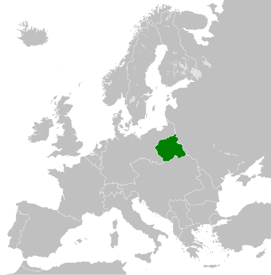
| DescriptionPoland 1918.png |
Polski: Położenie Królestwa Polskiego w Europie w 1918 roku. Mapa nie uwzględnia terenów okupowanych w trakcie I wojny światowej English: Localisation of Kingdom of Poland in 1918. |
| Date | |
| Source | Own work |
| Author | Pogo91 |
Licensing
I, the copyright holder of this work, hereby publish it under the following license:
This file is licensed under the Creative Commons Attribution-Share Alike 3.0 Unported license.
- You are free:
- to share – to copy, distribute and transmit the work
- to remix – to adapt the work
- Under the following conditions:
- attribution – You must give appropriate credit, provide a link to the license, and indicate if changes were made. You may do so in any reasonable manner, but not in any way that suggests the licensor endorses you or your use.
- share alike – If you remix, transform, or build upon the material, you must distribute your contributions under the same or compatible license as the original.
Captions
Add a one-line explanation of what this file represents
Items portrayed in this file
depicts
15 February 2014
File history
Click on a date/time to view the file as it appeared at that time.
| Date/Time | Thumbnail | Dimensions | User | Comment | |
|---|---|---|---|---|---|
| current | 17:32, 12 June 2015 | | 900 × 913 (102 KB) | Pogo91 | Właściwa granica Finlandii |
| 17:23, 12 June 2015 |  | 900 × 913 (102 KB) | Pogo91 | Granica wschodnia dodałem powiaty: Janowski, Radzyń, Bialski, Włodawski. Wzorowałem się na tej mapie: File:Krolpolskie1918kzo.png | |
| 14:43, 19 May 2015 |  | 900 × 913 (141 KB) | Pogo91 | The west border now is in a white color. | |
| 14:33, 15 January 2015 |  | 900 × 913 (103 KB) | Pogo91 | Broders are corrected according to File:OkupacjaKP1914-18.PNG. (This is still not final version). | |
| 15:27, 2 April 2014 |  | 900 × 913 (102 KB) | Pogo91 | I have corrected east polish border. | |
| 14:49, 15 March 2014 |  | 900 × 913 (102 KB) | Pogo91 | I have corrected african borders. Poprawiłem granice afrykańskie. | |
| 17:21, 15 February 2014 |  | 900 × 913 (140 KB) | Pogo91 | User created page with UploadWizard |
File usage
The following pages on the English Wikipedia use this file (pages on other projects are not listed):
Global file usage
The following other wikis use this file:
- Usage on az.wikipedia.org
- Usage on cs.wikipedia.org
- Usage on de.wikipedia.org
- Usage on es.wikipedia.org
- Usage on fa.wikipedia.org
- Usage on fi.wikipedia.org
- Usage on fr.wikipedia.org
- Usage on he.wikipedia.org
- Usage on it.wikipedia.org
- Usage on ja.wikipedia.org
- Usage on ko.wikipedia.org
- Usage on mk.wikipedia.org
- Usage on ms.wikipedia.org
- Usage on nl.wikipedia.org
- Usage on pl.wikipedia.org
- Usage on pt.wikipedia.org
- Usage on ru.wikipedia.org
- Usage on simple.wikipedia.org
- Usage on sr.wikipedia.org
- Usage on th.wikipedia.org
- Usage on uk.wikipedia.org
- Usage on vi.wikipedia.org
- Usage on zh.wikipedia.org
Retrieved from "https://en.wikipedia.org/wiki/File:Poland_1918.png"