File:Santa-barbara-island-nps-map.PNG
From Wikipedia, the free encyclopedia
No higher resolution available.
Santa-barbara-island-nps-map.PNG (485 × 425 pixels, file size: 16 KB, MIME type: image/png)
| This is a file from the Wikimedia Commons. Information from its description page there is shown below. Commons is a freely licensed media file repository. You can help. |
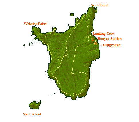
Summary
- NPS map of Santa Barbara Island — in Channel Islands National Park, Southern California.
- Showing campgrounds, trails, access coves, and adjacent islets.
converted from .gif into .png format
| Public domainPublic domainfalsefalse |
| This image or media file contains material based on a work of a National Park Service employee, created as part of that person's official duties. As a work of the U.S. federal government, such work is in the public domain in the United States. See the NPS website and NPS copyright policy for more information. |
File history
Click on a date/time to view the file as it appeared at that time.
| Date/Time | Thumbnail | Dimensions | User | Comment | |
|---|---|---|---|---|---|
| current | 14:04, 20 May 2009 | | 485 × 425 (16 KB) | Telim tor | NPS map of Santa Barbara Island, converted from .gif into .png format {{PD-USGov-NPS}} Category:Santa Barbara Island Category:Channel Islands National Park Category:Maps of California <!--{{ImageUpload|basic}}--> |
File usage
The following pages on the English Wikipedia use this file (pages on other projects are not listed):
Global file usage
The following other wikis use this file:
- Usage on gl.wikipedia.org
- Usage on it.wikipedia.org
- Usage on nl.wikipedia.org
- Usage on pl.wikipedia.org
Retrieved from "https://en.wikipedia.org/wiki/File:Santa-barbara-island-nps-map.PNG"