File:Sylhet_Division_districts_map.png
From Wikipedia, the free encyclopedia
No higher resolution available.
Sylhet_Division_districts_map.png (469 × 324 pixels, file size: 39 KB, MIME type: image/png)
| This is a file from the Wikimedia Commons. Information from its description page there is shown below. Commons is a freely licensed media file repository. You can help. |
Summary
| DescriptionSylhet Division districts map.png |
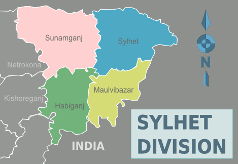
English: Colour-coded map of the districts of Sylhet Division in Bangladesh (Wikivoyage regional scheme), English version |
| Date | |
| Source | Own work based on the regional map of Bangladesh |
| Author | James Adams, Cacahuate |
| Other versions | SVG source |
Licensing
I, the copyright holder of this work, hereby publish it under the following license:
This file is licensed under the Creative Commons Attribution-Share Alike 3.0 Unported license.
- You are free:
- to share – to copy, distribute and transmit the work
- to remix – to adapt the work
- Under the following conditions:
- attribution – You must give appropriate credit, provide a link to the license, and indicate if changes were made. You may do so in any reasonable manner, but not in any way that suggests the licensor endorses you or your use.
- share alike – If you remix, transform, or build upon the material, you must distribute your contributions under the same or compatible license as the original.
Original upload log
| This file was imported from Wikivoyage WTS. |
The original description page was here. All following user names refer to wts.wikivoyage-old.
- 2008-08-24 18:52 (WT-shared) Cacahuate[dead link] 391×350 (39 KB) {{Imagecredit|credit=commons:User:Armanaziz, Peter Fitzgerald, Cacahuate|captureDate=|location=Bangladesh|source=[[: (Import from wikitravel.org/shared)
- 2012-09-29 09:07 (WT-shared) JamesA[dead link] 469×324 (39 KB) new colour-regionised format
Captions
Add a one-line explanation of what this file represents
Items portrayed in this file
depicts
some value
22 August 2012
image/png
File history
Click on a date/time to view the file as it appeared at that time.
| Date/Time | Thumbnail | Dimensions | User | Comment | |
|---|---|---|---|---|---|
| current | 02:05, 15 November 2012 | | 469 × 324 (39 KB) | OgreBot | (BOT): Reverting to most recent version before archival |
| 02:05, 15 November 2012 |  | 391 × 350 (39 KB) | OgreBot | (BOT): Uploading old version of file from wts.wikivoyage; originally uploaded on 2008-08-24 18:52:49 by (WT-shared) Cacahuate | |
| 01:36, 15 November 2012 |  | 469 × 324 (39 KB) | JamesA | User created page with UploadWizard |
File usage
The following pages on the English Wikipedia use this file (pages on other projects are not listed):
Global file usage
The following other wikis use this file:
- Usage on de.wikipedia.org
- Usage on fi.wikipedia.org
- Usage on frr.wikipedia.org
- Usage on hi.wikipedia.org
- Usage on nl.wikipedia.org
- Usage on pnb.wikipedia.org
- Usage on ur.wikipedia.org
Metadata
This file contains additional information, probably added from the digital camera or scanner used to create or digitize it.
If the file has been modified from its original state, some details may not fully reflect the modified file.
| Horizontal resolution | 37.79 dpc |
|---|---|
| Vertical resolution | 37.79 dpc |
| Software used |
Retrieved from "https://en.wikipedia.org/wiki/File:Sylhet_Division_districts_map.png"