File:The_River_Tay_and_Friarton_bridge.jpg
From Wikipedia, the free encyclopedia
No higher resolution available.
The_River_Tay_and_Friarton_bridge.jpg (640 × 480 pixels, file size: 123 KB, MIME type: image/jpeg)
| This is a file from the Wikimedia Commons. Information from its description page there is shown below. Commons is a freely licensed media file repository. You can help. |
Summary
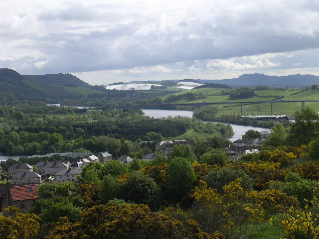
| DescriptionThe River Tay and Friarton bridge.jpg | The River Tay and Friarton bridge. The view is taken from Craigie Hill to the south of Perth looking east along the valley of the Tay. |
| Date | |
| Source | https://www.geograph.org.uk/photo/12097 |
| Author | Val Vannet |
| Permission (Reusing this file) |
Licensed for reuse under CC-BY-SA-2.0 |
| Object location | 56° 22′ 40″ N, 3° 26′ 02″ W | View this and other nearby images on: OpenStreetMap |
|---|
Licensing

|
This image was taken from the Geograph project collection. See this photograph's page on the Geograph website for the photographer's contact details. The copyright on this image is owned by Val Vannet and is licensed for reuse under the Creative Commons Attribution-ShareAlike 2.0 license.
|
This file is licensed under the Creative Commons Attribution-Share Alike 2.0 Generic license.
Attribution: Val Vannet
- You are free:
- to share – to copy, distribute and transmit the work
- to remix – to adapt the work
- Under the following conditions:
- attribution – You must give appropriate credit, provide a link to the license, and indicate if changes were made. You may do so in any reasonable manner, but not in any way that suggests the licensor endorses you or your use.
- share alike – If you remix, transform, or build upon the material, you must distribute your contributions under the same or compatible license as the original.
Original upload log
From en.wikipedia:
- 08:30, June 19, 2005 . . Erath 640×480 (125,585 bytes) (Copyright, Val Vannet. Taken 23 May 2005; found at http://www.geograph.co.uk/photo/12097 {{Cc-by-2.0}} )
Captions
Add a one-line explanation of what this file represents
Items portrayed in this file
depicts
23 May 2005
56°22'40.4"N, 3°26'2.4"W
0.00174003828084217852 second
4.4
14.5 millimetre
100
image/jpeg
File history
Click on a date/time to view the file as it appeared at that time.
| Date/Time | Thumbnail | Dimensions | User | Comment | |
|---|---|---|---|---|---|
| current | 15:06, 6 June 2007 | | 640 × 480 (123 KB) | Kjetil r | {{Information |Description=The River Tay and Friarton bridge. The view is taken from Craigie Hill to the south of Perth looking east along the valley of the Tay. |Source=http://www.geograph.org.uk/photo/12097 |Date=Monday, 23 May, 2005 |Author=[http://www |
File usage
The following pages on the English Wikipedia use this file (pages on other projects are not listed):
Global file usage
The following other wikis use this file:
- Usage on bg.wikipedia.org
- Usage on cs.wikipedia.org
- Usage on de.wikipedia.org
- Usage on es.wikipedia.org
- Usage on eu.wikipedia.org
- Usage on fa.wikipedia.org
- Usage on fr.wikipedia.org
- Usage on fy.wikipedia.org
- Usage on hu.wikipedia.org
- Usage on hy.wikipedia.org
- Usage on it.wikipedia.org
- Usage on lmo.wikipedia.org
- Usage on nl.wikipedia.org
- Usage on nn.wikipedia.org
- Usage on no.wikipedia.org
- Usage on pl.wikipedia.org
- Usage on pl.wikivoyage.org
- Usage on tr.wikipedia.org
- Usage on www.wikidata.org
Metadata
This file contains additional information, probably added from the digital camera or scanner used to create or digitize it.
If the file has been modified from its original state, some details may not fully reflect the modified file.
| Camera manufacturer | NIKON |
|---|---|
| Camera model | E3100 |
| Exposure time | 10/5,747 sec (0.0017400382808422) |
| F-number | f/4.4 |
| ISO speed rating | 100 |
| Date and time of data generation | 05:09, 23 May 2005 |
| Lens focal length | 14.5 mm |
| Orientation | Normal |
| Horizontal resolution | 300 dpi |
| Vertical resolution | 300 dpi |
| Software used | E3100v1.1 |
| File change date and time | 05:09, 23 May 2005 |
| Y and C positioning | Co-sited |
| Exposure Program | Normal program |
| Exif version | 2.2 |
| Date and time of digitizing | 05:09, 23 May 2005 |
| Meaning of each component |
|
| Image compression mode | 2 |
| Exposure bias | 0 |
| Maximum land aperture | 3 APEX (f/2.83) |
| Metering mode | Pattern |
| Light source | Unknown |
| Flash | Flash did not fire, auto mode |
| Supported Flashpix version | 1 |
| Color space | sRGB |
| File source | Digital still camera |
| Scene type | A directly photographed image |
| Custom image processing | Normal process |
| Exposure mode | Auto exposure |
| White balance | Auto white balance |
| Digital zoom ratio | 0 |
| Focal length in 35 mm film | 95 mm |
| Scene capture type | Standard |
| Scene control | None |
| Contrast | Normal |
| Saturation | Normal |
| Sharpness | Normal |
| Subject distance range | Unknown |