Portal:Myanmar
Wikipedia portal for content related to Myanmar (Burma) / From Wikipedia, the free encyclopedia
Portal maintenance status: (March 2022)
|
ကြိုဆိုပါတယ်။ / Welcome to the Myanmar Portal 

Myanmar, officially the Republic of the Union of Myanmar and also known as Burma (the official name until 1989), is a country in Southeast Asia. It is the largest country by area in Mainland Southeast Asia and has a population of about 55 million. It is bordered by Bangladesh and India to its northwest, China to its northeast, Laos and Thailand to its east and southeast, and the Andaman Sea and the Bay of Bengal to its south and southwest. The country's capital city is Naypyidaw, and its largest city is Yangon (formerly Rangoon).
Myanmar is a member of the East Asia Summit, Non-Aligned Movement, ASEAN, and BIMSTEC, but it is not a member of the Commonwealth of Nations despite once being part of the British Empire. Myanmar is a Dialogue Partner of the Shanghai Cooperation Organization. The country is very rich in natural resources, such as jade, gems, oil, natural gas, teak and other minerals, as well as also endowed with renewable energy, having the highest solar power potential compared to other countries of the Great Mekong Subregion. However, Myanmar has long suffered from instability, factional violence, corruption, poor infrastructure, as well as a long history of colonial exploitation with little regard to human development. In 2013, its GDP (nominal) stood at US$56.7 billion and its GDP (PPP) at US$221.5 billion. The income gap in Myanmar is among the widest in the world, as a large proportion of the economy is controlled by cronies of the military junta. Myanmar is one of the least developed countries; as of 2020, according to the Human Development Index, it ranks 147 out of 189 countries in terms of human development, the lowest in Southeast Asia. Since 2021, more than 600,000 people were displaced across Myanmar due to the surge in violence post-coup, with more than 3 million people in dire need of humanitarian assistance. (Full article...)
Selected articles - load new batch
 Image 1
 Burma and China prior to the war (1765)
The Sino-Burmese War (Chinese: 清緬戰爭; Burmese: တရုတ်-မြန်မာ စစ်ပွဲများ), also known as the Qing invasions of Burma or the Myanmar campaign of the Qing dynasty, was a war fought between the Qing dynasty of China and the Konbaung dynasty of Burma (Myanmar). China under the Qianlong Emperor launched four invasions of Burma between 1765 and 1769, which were considered one of his Ten Great Campaigns. Nonetheless, the war, which claimed the lives of over 70,000 Chinese soldiers and four commanders, is sometimes described as "the most disastrous frontier war that the Qing dynasty had ever waged", and one that "assured Burmese independence". Burma's successful defense laid the foundation for the present-day boundary between the two countries.
At first, the Qing emperor envisaged an easy war, and sent in only the Green Standard Army troops stationed in Yunnan. The Qing invasion came as the majority of Burmese forces were deployed in their latest invasion of Siam. Nonetheless, battle-hardened Burmese troops defeated the first two invasions of 1765–1766 and 1766–1767 at the border. The regional conflict now escalated to a major war that involved military maneuvers nationwide in both countries. The third invasion (1767–1768) led by the elite Manchu Bannermen nearly succeeded, penetrating deep into central Burma within a few days' march from the capital, Ava (Inwa). But the bannermen of northern China could not cope with unfamiliar tropical terrains and lethal endemic diseases, and were driven back with heavy losses. After the close call, King Hsinbyushin redeployed his armies from Siam to the Chinese front. The fourth and largest invasion got bogged down at the frontier. With the Qing forces completely encircled, a truce was reached between the field commanders of the two sides in December 1769. (Full article...)- Image 2Tattooing in Burma was a widespread custom practiced by various ethnic groups, including the Bamar, Shan, and Karen, until the 20th century. Tattooing was a distinguishing cultural marker and a symbol of strength, courage and intimidation for Lethwei fighters. (Full article...)
- Image 3

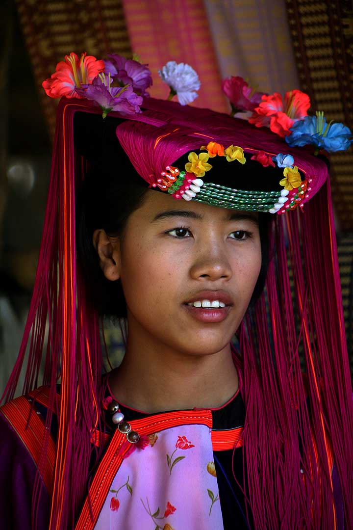

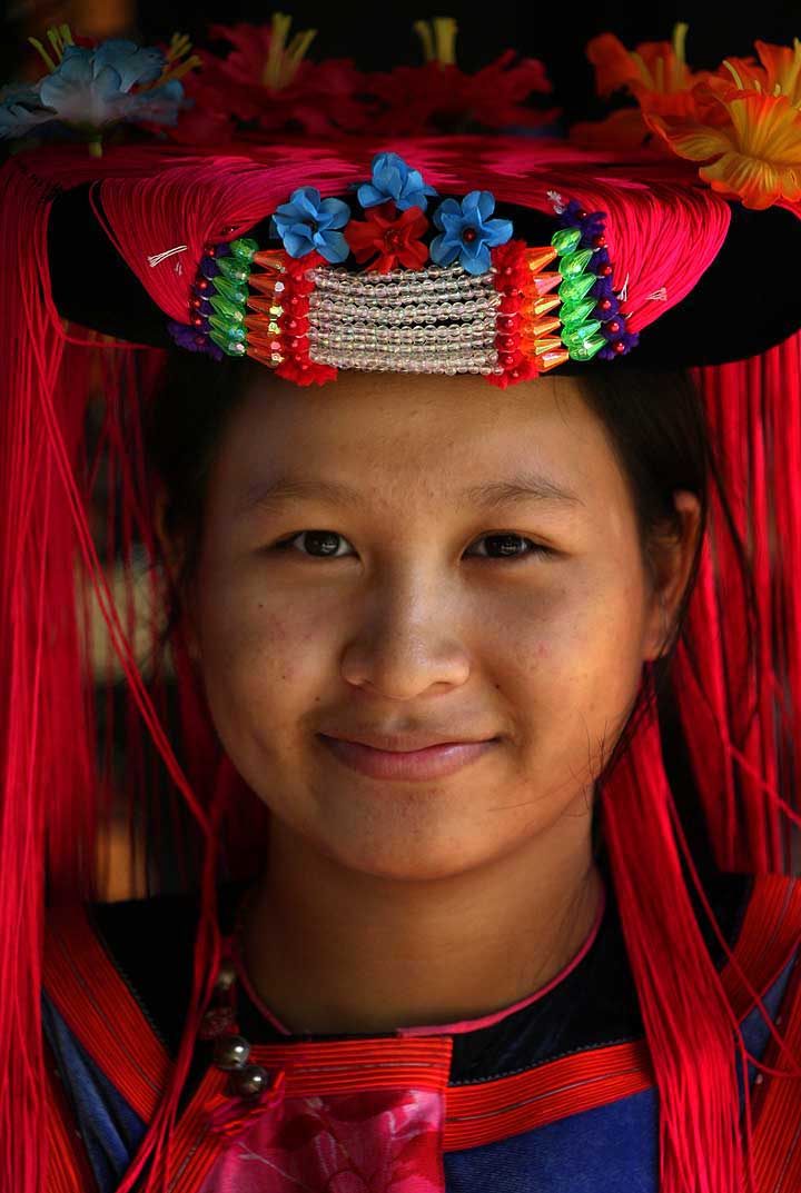
The Lisu people (Lisu: ꓡꓲ‐ꓢꓴ ꓫꓵꓽ; Burmese: လီဆူလူမျိုး, [lìsʰù]; Chinese: 傈僳族; pinyin: Lìsùzú; Thai: ลีสู่) are a Tibeto-Burman ethnic group who inhabit mountainous regions of Myanmar (Burma), southwest China, Thailand, and the Indian state of Arunachal Pradesh.
About 730,000 Lisu live in Lijiang, Baoshan, Nujiang, Dêqên and Dehong prefectures in Yunnan Province and Sichuan Province, China. The Lisu form one of the 56 ethnic groups officially recognized by China. In Myanmar, the Lisu are recognized as one of 135 ethnic groups and an estimated population of 600,000. Lisu live in the north of the country; Kachin State (Putao, Myitkyina, Danai, Waingmaw, Bhamo), Shan State (Momeik, Namhsan, Lashio, Hopang, and Kokang) and southern Shan State (Namsang, Loilem, Mongton), and Sagaing Division (Katha and Khamti), Mandalay Division (Mogok and Pyin Oo Lwin). Approximately 55,000 live in Thailand, where they are one of the six main hill tribes. They mainly inhabit remote mountainous areas. (Full article...) - Image 4The military history of Myanmar (Burma) spans over a millennium, and is one of the main factors that have shaped the history of the country, and to a certain degree, the history of Southeast Asia. At various times in history, successive Burmese kingdoms were also involved in warfare against their neighbouring states in the surrounding regions of modern Burmese borders—from Bengal, Manipur and Assam in the west, to Yunnan (the southern China) in the northeast, to Laos and Siam in the east and southeast.
The Royal Burmese Army was a major Southeast Asian armed force between the 11th and 13th centuries and between 16th and 19th centuries. It was the premier military force in the 16th century when the Toungoo dynasty built the largest empire in the history of Southeast Asia. The centuries-long warfare between Burma and Siam (1547–1855) shaped not only the history of both countries but also that of mainland Southeast Asia. In the 18th and early 19th centuries, highly militaristic Konbaung kings had built the largest empire in mainland Southeast Asia until they encountered the British in present-day northeast India. Prior to the three Anglo-Burmese wars (1824–1885), previous existential threats to the country had come from China in the form of Mongol invasions (1277–1301) and Manchu invasions (1765–1769). (Full article...) - Image 5
 Map of Bay of Bengal
The Bay of Bengal is the northeastern part of the Indian Ocean. The world's largest bay, geographically it is positioned between the Indian subcontinent and the Indochinese peninsula, located below the Bengal region / Current Bangladesh (based on which the bay was named during the British Raj).
Many South Asian and Southeast Asian countries are dependent on the Bay of Bengal. Geopolitically, the bay is bounded on the west and northwest by India, on the north by Bangladesh, and on the east by Myanmar and the Andaman and Nicobar Islands of India. Its southern limit is a line between Sangaman Kanda, Sri Lanka, and the northwesternmost point of Sumatra, Indonesia. Cox's Bazar, the longest sea beach in the world and Sundarbans, the largest mangrove forest and the natural habitat of the Bengal tiger, are located along the bay. (Full article...) - Image 6
 Yangon, the financial center of Myanmar
The economy of Myanmar is the seventh largest in Southeast Asia. After the return of civilian rule in 2011, the new government launched large-scale reforms, focused initially on the political system to restore peace and achieve national unity and moving quickly to an economic and social reform program. Current economic statistics were a huge decline from the economic statistics of Myanmar in the fiscal year of 2020, in which Myanmar’s nominal GDP was $81.26 billion and its purchasing power adjusted GDP was $279.14 billion. Myanmar has faced an economic crisis since the 2021 coup d'état. (Full article...) - Image 7
 Aerial view of the river
The Irrawaddy River (Burmese: ဧရာဝတီမြစ်, pronounced [ʔèjàwədì mjɪʔ], official romanisation: Ayeyarwady) is the largest river in Myanmar. Originating from the confluence of the N'mai and Mali rivers, it flows from north to south before emptying through the Irrawaddy Delta in the Ayeyarwady Region into the Andaman Sea. Its drainage basin of about 404,000 square kilometres (156,000 sq mi) covers 61% of the land area of Burma, and contains five of its largest cities.
As early as the sixth century, the river was used for trade and transport, and an extensive network of irrigation canals was developed to support agriculture. The river is still of great importance as the largest commercial waterway of Myanmar. It also provides important ecosystem services to different communities and economic sectors, including agriculture, fisheries, and tourism. (Full article...) - Image 8
Mandalay Region (Burmese: မန္တလေးတိုင်းဒေသကြီး, pronounced [máɰ̃dəlé táiɰ̃ dèθa̰ dʑí]; formerly Mandalay Division) is an administrative division of Myanmar. It is located in the center of the country, bordering Sagaing Region and Magway Region to the west, Shan State to the east, and Bago Region and Kayin State to the south. The regional capital is Mandalay. To the south of the region lies the national capital of Naypyidaw. The division consists of eleven districts, which are subdivided into 28 townships and 2,320 wards and village-tracts.
Mandalay Region is important in Myanmar's economy, accounting for 15% of the national economy. It is under the administration of the Mandalay Region Government. (Full article...) - Image 9The 969 Movement (Burmese: ၉၆၉ လှုပ်ရှားမှု) is a Buddhist nationalist movement opposed to what they see as Islam's expansion in predominantly Buddhist Myanmar (Burma). The three digits of 969 "symbolize the virtues of the Buddha, Buddhist practices and the Buddhist community". The first 9 stands for the nine special attributes of the Buddha and the 6 for the six special attributes of his Dharma, or Buddhist Teachings, and the last 9 represents the nine special attributes of Buddhist Sangha (monastic community). Those special attributes are the Three Jewels of the Buddha. In the past, the Buddha, Sangha, Dhamma, the wheel of Dhamma, and "969" were Buddhist signs.
The movement has had strong reactions within and beyond Myanmar. In the international media it has received criticism. The Straits Times reported that Ashin Wirathu, the movement's leader, responded to recent anti-Muslim violence with pledges to work for peace, but critics remain sceptical. (Full article...) - Image 10

The British colonial rule in Burma lasted from 1824 to 1948, from the successive three Anglo-Burmese wars through the creation of Burma as a province of British India to the establishment of an independently administered colony, and finally independence. The region under British control was known as British Burma, and officially known as Burma (Burmese: မြန်မာနိုင်ငံတော်) from 1886. Various portions of Burmese territories, including Arakan and Tenasserim, were annexed by the British after their victory in the First Anglo-Burmese War; Lower Burma was annexed in 1852 after the Second Anglo-Burmese War. The annexed territories were designated the minor province (a chief commissionership) of British Burma in 1862.
After the Third Anglo-Burmese War in 1885, Upper Burma was annexed, and the following year, the province of Burma in British India was created, becoming a major province (a lieutenant-governorship) in 1897. This arrangement lasted until 1937, when Burma began to be administered separately by the Burma Office under the Secretary of State for India and Burma. British rule was disrupted during the Japanese occupation of much of the country during World War II. Burma achieved independence from British rule on 4 January 1948. (Full article...)


.svg)
Did you know (auto-generated) - load new batch

- ... that Esther Ze Naw, who appeared on the 2021 Time 100, was one of the few people in Myanmar who protested against Aung San Suu Kyi's defence of the military at the International Court of Justice in December 2019?
- ... that as part of the coronation of Mindon Min, the square yuzana around the capital was designated a sanctuary?
- ... that the Burmese and South Korean first ladies held their first informal conversation 44 years after the establishment of bilateral relations between the two countries?
- ... that the Myanmar Coast Guard was initially proposed as a civilian law enforcement agency before being established as a branch of the military three years later?
- ... that former Burmese actress Honey Nway Oo turned rebel and took up arms against the military junta following the 2021 Myanmar coup d'état?
- ... that the talabaw soup, which consists primarily of bamboo shoots, is the essential dish of Myanmar's Karen people, who use it to supplement rice?
- ... that Maung O, Prince of Salin, and his sister Nanmadaw Me Nu became de facto rulers of Burma when King Bagyidaw was suffering from depression?
- ... that squatters in Myanmar were punished for protesting against the 2021 coup d'état by being evicted?
Related portals and projects
Southeast Asia
Other Countries
General images - load new batch
 Image 1A theatrical performance of the Mon dance (from Culture of Myanmar)

 Image 4A bull fight, 19th-century watercolour (from Culture of Myanmar)
 Image 5Portuguese ruler and soldiers mounting an Elephant. Philips, Jan Caspar (draughtsman and engraver) (from History of Myanmar)
 Image 619th-century funeral cart and spire, which would form part of the procession from the home to the place of cremation (from Culture of Myanmar)
 Image 7Myinhkin thabin - equestrian sport (from Culture of Myanmar)
 Image 8Pagan Kingdom during Narapatisithu's reign. Burmese chronicles also claim Kengtung and Chiang Mai. Core areas shown in darker yellow. Peripheral areas in light yellow. Pagan incorporated key ports of Lower Burma into its core administration by the 13th century. (from History of Myanmar)
 Image 9Two female musicians play the saung at a performance in Mandalay. (from Culture of Myanmar)
 Image 10Political Map of Burma (Myanmar) c. 1450 CE. (from History of Myanmar)
 Image 11Salween river at Mae Sam Laep on the Thai-Myanmar border (from Geography of Myanmar)
 Image 12Sculpture of Myanmar mythical lion (from Culture of Myanmar)
 Image 13A large fracture on the Mingun Pahtodawgyi caused by the 1839 Ava earthquake. (from Geography of Myanmar)
 Image 14Boxing match, 19th-century watercolour (from Culture of Myanmar)

 Image 17The restored Taungoo or Nyaungyan dynasty c. 1650 CE. (from History of Myanmar)
 Image 18Former US President Barack Obama poses barefoot on the grounds of Shwedagon Pagoda, one of Myanmar's major Buddhist pilgrimage sites. (from Culture of Myanmar)
 Image 19British soldiers on patrol in the ruins of the Burmese town of Bahe during the advance on Mandalay, January 1945. (from History of Myanmar)
 Image 20Temples at Mrauk U, was the capital of the Mrauk U Kingdom, which ruled over what is now Rakhine State. (from History of Myanmar)
 Image 21Saint Mary's Cathedral in Downtown Yangon is the largest Roman Catholic cathedral in Burma. (from Culture of Myanmar)
 Image 22Myanmar (Burma) map of Köppen climate classification (from Geography of Myanmar)
 Image 24Aung San Suu Kyi addresses crowds at the NLD headquarters shortly after her release. (from History of Myanmar)
 Image 26The shores of Irrawaddy River at Nyaung-U, Bagan (from Geography of Myanmar)
 Image 27Hlei pyaingbwè - a Burmese regatta (from Culture of Myanmar)
 Image 29The paddle steamer Ramapoora (right) of the British India Steam Navigation Company on the Rangoon river having just arrived from Moulmein. 1895. Photographers: Watts and Skeen (from History of Myanmar)
 Image 30British soldiers remove their shoes at the entrance of Shwedagon Pagoda. To the left, a sign reads "Foot wearing is strictly prohibited" in Burmese, English, Tamil, and Urdu. (from Culture of Myanmar)
 Image 32Vegetable stall on the roadside at the Madras Lancer Lines, Mandalay, January 1886. Photographer: Hooper, Willoughby Wallace (1837–1912). (from History of Myanmar)
 Image 33British soldiers dismantling cannons belonging to King Thibaw's forces, Third Anglo-Burmese War, Ava, 27 November 1885. Photographer: Hooper, Willoughby Wallace (1837–1912). (from History of Myanmar)
 Image 34Grandfather Island, Dawei (from Geography of Myanmar)
 Image 35A wedding procession, with the groom and bride dressed in traditional Burmese wedding clothes, reminiscent of royal attire (from Culture of Myanmar)
 Image 36Protesters in Yangon with a banner that reads non-violence: national movement in Burmese, in the background is Shwedagon Pagoda. (from History of Myanmar)
 Image 37Aerial view of a burned Rohingya village in Rakhine state, Myanmar, September 2017 (from History of Myanmar)
 Image 38A group of Buddhist worshipers at Shwedagon Pagoda, an important religious site for Burmese Buddhists (from Culture of Myanmar)
 Image 39Protesters in Yangon carrying signs reading "Free Daw Aung San Suu Kyi" on 8 February 2021. (from History of Myanmar)
 Image 40Recorder's Court on Sule Pagoda Road, with the Sule Pagoda at the far end, Rangoon, 1868. Photographer: J. Jackson. (from History of Myanmar)


_headquarter.jpg)


Major topics
Categories

More topics
|
|
|
Associated Wikimedia
The following Wikimedia Foundation sister projects provide more on this subject:
-
 Commons
Free media repository -
 Wikibooks
Free textbooks and manuals -
 Wikidata
Free knowledge base -
 Wikinews
Free-content news -
 Wikiquote
Collection of quotations -
 Wikisource
Free-content library -
 Wikiversity
Free learning tools -
 Wikivoyage
Free travel guide -
 Wiktionary
Dictionary and thesaurus


