
Coleville, California
Census-designated place in California, United States / From Wikipedia, the free encyclopedia
Dear Wikiwand AI, let's keep it short by simply answering these key questions:
Can you list the top facts and stats about Coleville, California?
Summarize this article for a 10 year old
SHOW ALL QUESTIONS
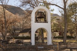
Coleville is an unincorporated community and census-designated place (CDP)[4] in Mono County, California, United States.[2] It is located at an elevation of 5,141 feet (1,567 m) in the Antelope Valley on the West Walker River.[2] The population was 419 at the 2020 census,[3] down from 495 at the 2010 census.
Quick Facts Country, State ...
Coleville, California | |
|---|---|
 Coleville | |
 Coleville  Coleville | |
| Coordinates: 38°33′59″N 119°30′26″W | |
| Country | United States |
| State | California |
| County | Mono |
| Area | |
| • Total | 19.27 sq mi (49.90 km2) |
| • Land | 19.27 sq mi (49.90 km2) |
| • Water | 0.00 sq mi (0.00 km2) 0% |
| Elevation | 5,141 ft (1,567 m) |
| Population | |
| • Total | 419 |
| • Density | 21.75/sq mi (8.40/km2) |
| Time zone | UTC-8 (Pacific) |
| • Summer (DST) | UTC-7 (PDT) |
| ZIP code | 96107 |
| Area codes | 442/760 (de jure); 530 (de facto) |
| FIPS code | 06-14484 |
| GNIS feature IDs | 1655911, 2582978 |
| U.S. Geological Survey Geographic Names Information System: Coleville, California; U.S. Geological Survey Geographic Names Information System: Coleville, California | |
Close
The ZIP Code is 96107, and the community is inside area codes 442 and 760.