
Puerto Rico Highway 24
Highway in Puerto Rico / From Wikipedia, the free encyclopedia
Dear Wikiwand AI, let's keep it short by simply answering these key questions:
Can you list the top facts and stats about Puerto Rico Highway 24?
Summarize this article for a 10 year old
SHOW ALL QUESTIONS
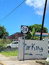
Puerto Rico Highway 24 (PR-24) is a north–south road located between the municipalities of Cataño and Guaynabo, Puerto Rico.[2] This highway extends from Avenida Las Nereidas (PR-888) in downtown Cataño to Avenida El Caño (PR-165) near the Metropolitan Detention Center, Guaynabo. In Cataño, it is known as Calle Wilson,[3] and in Guaynabo, as Avenida Juan Ponce de León.[4]
- Puerto Rico Highway 24
 Heading north in Amelia, Guaynabo
 Heading north in downtown Cataño

.jpg)
Quick Facts Highway 24, Route information ...
Highway 24 | ||||
|---|---|---|---|---|
| Ruta 24 | ||||
| Route information | ||||
| Maintained by Puerto Rico DTPW | ||||
| Length | 1.7 km[1] (1.1 mi) | |||
| Major junctions | ||||
| South end | ||||
| Major intersections | ||||
| North end | ||||
| Location | ||||
| Country | United States | |||
| Territory | Puerto Rico | |||
| Municipalities | Guaynabo, Cataño | |||
| Highway system | ||||
| ||||

Close